

Federation Square to the "Africa" Loop/Sunshine
A cycling route starting in Southbank, Victoria, Australia.
Overview
About this route
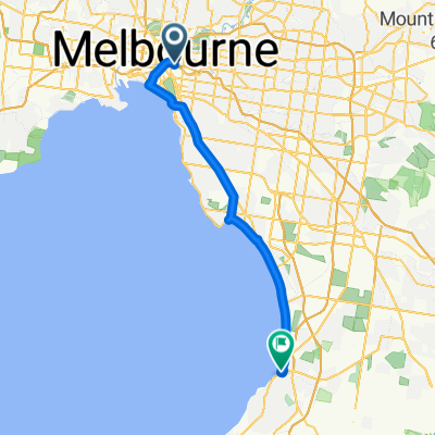
This route leaves from Federation Square towards Sunshine station, and then does a loop around the Kororoit Creek and M80 trails to form a "map" of Africa, ending back at Sunshine station
- -:--
- Duration
- 38.6 km
- Distance
- 73 m
- Ascent
- 40 m
- Descent
- ---
- Avg. speed
- 47 m
- Max. altitude
Route quality
Waytypes & surfaces along the route
Waytypes
Cycleway
33.6 km
(87 %)
Quiet road
2.7 km
(7 %)
Surfaces
Paved
37 km
(96 %)
Concrete
19.7 km
(51 %)
Asphalt
14.7 km
(38 %)
Continue with Bikemap
Use, edit, or download this cycling route
You would like to ride Federation Square to the "Africa" Loop/Sunshine or customize it for your own trip? Here is what you can do with this Bikemap route:
Free features
- Save this route as favorite or in collections
- Copy & plan your own version of this route
- Sync your route with Garmin or Wahoo
Premium features
Free trial for 3 days, or one-time payment. More about Bikemap Premium.
- Navigate this route on iOS & Android
- Export a GPX / KML file of this route
- Create your custom printout (try it for free)
- Download this route for offline navigation
Discover more Premium features.
Get Bikemap PremiumFrom our community
Other popular routes starting in Southbank
 Flinders Stn. to IDC
- Distance
- 9.6 km
- Ascent
- 95 m
- Descent
- 96 m
- Location
- Southbank, Victoria, Australia
 Federation Square to the "Africa" Loop/Sunshine
- Distance
- 38.6 km
- Ascent
- 73 m
- Descent
- 40 m
- Location
- Southbank, Victoria, Australia
 Federation Square to Abbotsford Convent Loop
- Distance
- 26.7 km
- Ascent
- 84 m
- Descent
- 84 m
- Location
- Southbank, Victoria, Australia
 Frankston Route
- Distance
- 46.5 km
- Ascent
- 96 m
- Descent
- 79 m
- Location
- Southbank, Victoria, Australia
 Southbank to Gardener creek trail
- Distance
- 22.2 km
- Ascent
- 149 m
- Descent
- 145 m
- Location
- Southbank, Victoria, Australia
 Anniversary Trail Circuit
- Distance
- 36.5 km
- Ascent
- 0 m
- Descent
- 0 m
- Location
- Southbank, Victoria, Australia
 Federation Square to Ashburton Loop
- Distance
- 30 km
- Ascent
- 94 m
- Descent
- 94 m
- Location
- Southbank, Victoria, Australia
 Melbourne City Circle
- Distance
- 30.2 km
- Ascent
- 128 m
- Descent
- 131 m
- Location
- Southbank, Victoria, Australia
Open it in the app