'9-Camino - San Millán de la Cogolla.
A cycling route starting in Nájera, La Rioja, Spain.
Overview
About this route
A detour worth taking.
- -:--
- Duration
- 42.6 km
- Distance
- 585 m
- Ascent
- 429 m
- Descent
- ---
- Avg. speed
- ---
- Max. altitude
Route quality
Waytypes & surfaces along the route
Waytypes
Road
7.2 km
(17 %)
Quiet road
3.8 km
(9 %)
Surfaces
Paved
2.6 km
(6 %)
Unpaved
2.6 km
(6 %)
Asphalt
2.6 km
(6 %)
Gravel
2.6 km
(6 %)
Undefined
37.5 km
(88 %)
Route highlights
Points of interest along the route
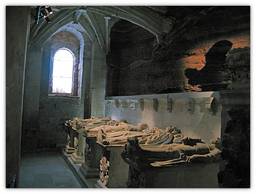
Point of interest after 0.2 km
Nájera Iglesia de Santa Cruz (XVIe-XVIIe). Capilla de la Madre de Díos – XVIe. Monasterio de Santa María la Real (1045), Panteón Real de los reyes de Najera-Navarra y sepulcro de reyes castellano-leoneses. Actual iglesia (XVe-XVIIe). Convento de Santa Elena (XVIe-XVIIe). Castillo de la Mota (IXe-Xe). Alcázar (Xe-XVIe). Castillo de Malpica (XIIe). Muralla. Puente de San Juan de Ortega (XIIe) (obra actuel XIXe).
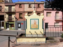
Point of interest after 6.9 km
Cárdenas Iglesia de la Asunción (XVIe-XVIIe).
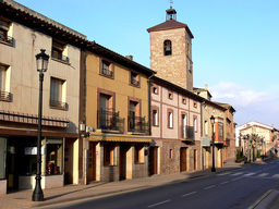
Point of interest after 10.9 km
Badarán Iglesia de Nuestra Señora de la Expectación.
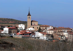
Point of interest after 16.1 km
Berceo Iglesia de Santa Eulalia de Mérida (XIXe).
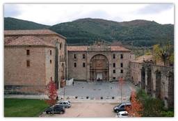
Point of interest after 17.4 km
San Millán de la Cogolla. Monasterio de Suso (visigótico, mozárabe y prerománico. Ermita de San Roque. Fuente de San Millán.
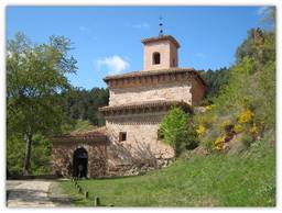
Point of interest after 19.7 km
San Millán de la Cogolla. Monasterion de San Millán de la Cogolla o de Yuso (XIe-XVIIe) (contiene el sepulcro del Santo).

Point of interest after 29.5 km
Cañas Monasterio Cisterciense de Cañas (XIIe-XIIIe-XVIIe). Iglesia de la Asunción (XIIe-XVIe-XVIIIe). Ermita de Santa María (XVIe).

Point of interest after 35 km
Cirueña Iglesia de San Andrés (Xe). Ermita de la Virgen de los Remedíos.

Point of interest after 42.5 km
Santo Domingo de la Calzada Catedral de Santo Domingo (XIIe-XVIIIe). Sepulcro del Santo. Gallinero. Torre Exenta (XVIIIe) (barroco 69m). Ermita de Nuestra Senora de la Plaza (XVe-XVIe). Convento de San Francisco (XVIIe). Abadía cisterciense de Nuestra Señora de la Anunciación (XVIIe). Puerta del Camino. Casa de Trastámara – del marqués de la Ensenada. Casa de la Cofradía del Santo. Casa del secretario de Carlos V. Antiguo hospital de peregrinos. Muralla (XIVe). Puente de Santo Domingo (XIe). Ermita del Santo (puente). Monumento de los Peregrinos (1969).
Continue with Bikemap
Use, edit, or download this cycling route
You would like to ride '9-Camino - San Millán de la Cogolla. or customize it for your own trip? Here is what you can do with this Bikemap route:
Free features
- Save this route as favorite or in collections
- Copy & plan your own version of this route
- Sync your route with Garmin or Wahoo
Premium features
Free trial for 3 days, or one-time payment. More about Bikemap Premium.
- Navigate this route on iOS & Android
- Export a GPX / KML file of this route
- Create your custom printout (try it for free)
- Download this route for offline navigation
Discover more Premium features.
Get Bikemap PremiumFrom our community
Other popular routes starting in Nájera
 2ª Najera-Quintanar de la Sierra.
- Distance
- 77.6 km
- Ascent
- 1,081 m
- Descent
- 464 m
- Location
- Nájera, La Rioja, Spain
 Camino day 4
- Distance
- 54.9 km
- Ascent
- 805 m
- Descent
- 354 m
- Location
- Nájera, La Rioja, Spain
 Rodear a La Demanda
- Distance
- 178.2 km
- Ascent
- 1,555 m
- Descent
- 1,555 m
- Location
- Nájera, La Rioja, Spain
 Falkenfels Bühlertal 3. Etappe: Najera_Santo Domingo de Silos
- Distance
- 144.5 km
- Ascent
- 3,392 m
- Descent
- 2,870 m
- Location
- Nájera, La Rioja, Spain
 Camino de Santiago. Etapa 3. Nájera - Olmillos de Sasamón
- Distance
- 118.9 km
- Ascent
- 952 m
- Descent
- 610 m
- Location
- Nájera, La Rioja, Spain
 2011 Santiago 3.dan (Najera - Ages)
- Distance
- 70.8 km
- Ascent
- 818 m
- Descent
- 347 m
- Location
- Nájera, La Rioja, Spain
 Nájera - Logroňo
- Distance
- 77.4 km
- Ascent
- 679 m
- Descent
- 673 m
- Location
- Nájera, La Rioja, Spain
 Camino Day 4
- Distance
- 66.8 km
- Ascent
- 944 m
- Descent
- 487 m
- Location
- Nájera, La Rioja, Spain
Open it in the app


