Recovered Route
A cycling route starting in Saint Matthews, Kentucky, United States.
Overview
About this route
- 2 h 10 min
- Duration
- 49.1 km
- Distance
- 254 m
- Ascent
- 258 m
- Descent
- 22.7 km/h
- Avg. speed
- 178 m
- Max. altitude
Route photos
Route quality
Waytypes & surfaces along the route
Waytypes
Quiet road
20.6 km
(42 %)
Road
7.4 km
(15 %)
Surfaces
Paved
11.8 km
(24 %)
Paved (undefined)
6.9 km
(14 %)
Concrete
4.9 km
(10 %)
Undefined
37.3 km
(76 %)
Continue with Bikemap
Use, edit, or download this cycling route
You would like to ride Recovered Route or customize it for your own trip? Here is what you can do with this Bikemap route:
Free features
- Save this route as favorite or in collections
- Copy & plan your own version of this route
- Sync your route with Garmin or Wahoo
Premium features
Free trial for 3 days, or one-time payment. More about Bikemap Premium.
- Navigate this route on iOS & Android
- Export a GPX / KML file of this route
- Create your custom printout (try it for free)
- Download this route for offline navigation
Discover more Premium features.
Get Bikemap PremiumFrom our community
Other popular routes starting in Saint Matthews
- Charlestown State 40 miler
- Distance
- 64.5 km
- Ascent
- 231 m
- Descent
- 232 m
- Location
- Saint Matthews, Kentucky, United States
- 3535 Winchester Rd, St. Matthews to 3536 Graham Rd, St. Matthews
- Distance
- 23.5 km
- Ascent
- 133 m
- Descent
- 135 m
- Location
- Saint Matthews, Kentucky, United States
- Eline to Extol
- Distance
- 17.7 km
- Ascent
- 54 m
- Descent
- 80 m
- Location
- Saint Matthews, Kentucky, United States
- Recovered Route
- Distance
- 38.3 km
- Ascent
- 162 m
- Descent
- 164 m
- Location
- Saint Matthews, Kentucky, United States
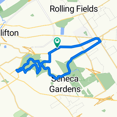
- Louisville Sunday Route
- Distance
- 22 km
- Ascent
- 318 m
- Descent
- 316 m
- Location
- Saint Matthews, Kentucky, United States
- Home to Broadway Nutrition
- Distance
- 11 km
- Ascent
- 48 m
- Descent
- 75 m
- Location
- Saint Matthews, Kentucky, United States
- Recovered Route
- Distance
- 50.2 km
- Ascent
- 226 m
- Descent
- 224 m
- Location
- Saint Matthews, Kentucky, United States
- Recovered Route
- Distance
- 49.1 km
- Ascent
- 254 m
- Descent
- 258 m
- Location
- Saint Matthews, Kentucky, United States
Open it in the app