Über den Höchsten und den Judentenberg
- 56.5 km
- 607 m
- 610 m
- Ostrach, Baden-Wurttemberg, Germany
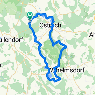
A cycling route starting in Ostrach, Baden-Wurttemberg, Germany.
Overview
Route:
demanding
Surroundings:
dreamy
Length:
75 km
Ascents:
many small steep ones
Roads:
all paved, little traffic
Description:
A scenically beautiful route with a few short but steep ascents. Hardly any main roads, plenty of rest and refreshment opportunities, and you always meet fellow cyclists.
Start is in Ostrach, from there you head towards Krauchenwies on the main road, which is soon left to the right over a small bridge towards Jettkofen, Einhart, Eimühle. After Eimühle, you turn right onto the little-used country road towards Rosna. Through Rulfingen, Zielfingen, you reach Sigdorf. Just before the Danube bridge, you take the bike path towards Sigmaringen, passing through its downtown towards the town hall, to reach Laiz via the Danube bike path. Across the Danube bridge, you now reach the Donautal road that you follow towards Gutenstein. Especially on weekends, there is unfortunately a lot of motorcycle and car traffic here, caution is advised.
Just before Gutenstein, turn left over the Danube, where the climb to Langenhart begins. Through Rohrdorf, you reach Messkirch, passing through its downtown towards the train station, underneath the federal road and heading to Igelswies. On small roads, the flat path runs alongside the Ablach to Göggingen. In the village center, you briefly navigate a section of the federal road (100m), then turn left onto the little ascent towards Bittelschiess. After this village, continue on the country road through Ettisweiler (beware of gravel pit, lots of gravel on the road) to Hausen a.A. In the village center at the fountain, turn left towards Pfullendorf. In Schwäblishausen, turn left onto the short ascent towards Mottschiess. Follow the country road to Lausheim, and in the center, after a small descent, turn right towards Magenbuch. After Magenbuch, you briefly go into the woods, where after a steep, short descent, turn left through the woods on the country road towards Jettkofen. From there, retrace the same way as on the outward journey back to Ostrach.
Done!
Route quality
Road
37.1 km
53 %
Quiet road
14 km
20 %
Paved
53.2 km
(76 %)
Unpaved
2.8 km
(4 %)
Asphalt
53.2 km
76 %
Unpaved (undefined)
1.4 km
2 %
Continue with Bikemap
You would like to ride Ostrach-Donautal-Ablachtal-Ostrach or customize it for your own trip? Here is what you can do with this Bikemap route:
Free trial for 3 days, or one-time payment. More about Bikemap Premium.
Discover more Premium features.
Get Bikemap PremiumFrom our community
Open it in the app