

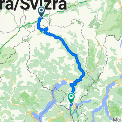
1. Lai da Tuma - Trun 13.06.12
A cycling route starting in Andermatt, Canton of Uri, Switzerland.
Overview
About this route
- Etappe Projekt 1333km RUN FOR KIDS 13.06.12
Lai da Tuma - Trun 37km
- -:--
- Duration
- 37.2 km
- Distance
- 288 m
- Ascent
- 1,801 m
- Descent
- ---
- Avg. speed
- ---
- Max. altitude

Continue with Bikemap
Use, edit, or download this cycling route
You would like to ride 1. Lai da Tuma - Trun 13.06.12 or customize it for your own trip? Here is what you can do with this Bikemap route:
Free features
- Save this route as favorite or in collections
- Copy & plan your own version of this route
- Sync your route with Garmin or Wahoo
Premium features
Free trial for 3 days, or one-time payment. More about Bikemap Premium.
- Navigate this route on iOS & Android
- Export a GPX / KML file of this route
- Create your custom printout (try it for free)
- Download this route for offline navigation
Discover more Premium features.
Get Bikemap PremiumFrom our community
Other popular routes starting in Andermatt
 Rheinradweg
- Distance
- 1,085.7 km
- Ascent
- 107 m
- Descent
- 1,544 m
- Location
- Andermatt, Canton of Uri, Switzerland
 Bellinzona - Vizzola Ticino
- Distance
- 130.7 km
- Ascent
- 2,639 m
- Descent
- 3,799 m
- Location
- Andermatt, Canton of Uri, Switzerland
 Transalpine (7) Andermatt - Visp
- Distance
- 89.5 km
- Ascent
- 1,685 m
- Descent
- 2,290 m
- Location
- Andermatt, Canton of Uri, Switzerland
![[DAY 19] Göschenen - Ilanz](https://media.bikemap.net/routes/8561780/gallery/thumbs/af10c4bc-a85d-4013-8c11-c6c25ccc528a.jpeg.208x208_q80_crop.jpg) [DAY 19] Göschenen - Ilanz
[DAY 19] Göschenen - Ilanz- Distance
- 68.1 km
- Ascent
- 984 m
- Descent
- 1,380 m
- Location
- Andermatt, Canton of Uri, Switzerland
 20.09.2010 Furka, Nufenen, Gotthard
- Distance
- 98.5 km
- Ascent
- 2,959 m
- Descent
- 2,959 m
- Location
- Andermatt, Canton of Uri, Switzerland
 giro dei tre passi susten grimsel furka
- Distance
- 132.9 km
- Ascent
- 3,457 m
- Descent
- 3,601 m
- Location
- Andermatt, Canton of Uri, Switzerland
 Furka-Nufenen-Gotthard-Oberalp
- Distance
- 135.9 km
- Ascent
- 4,637 m
- Descent
- 4,527 m
- Location
- Andermatt, Canton of Uri, Switzerland
 NL The Rhine Cycle Route
- Distance
- 1,352.1 km
- Ascent
- 88 m
- Descent
- 1,523 m
- Location
- Andermatt, Canton of Uri, Switzerland
Open it in the app