

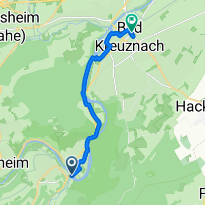
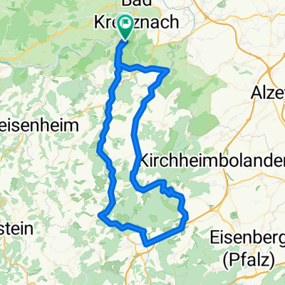
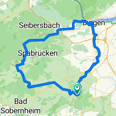
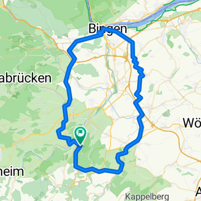
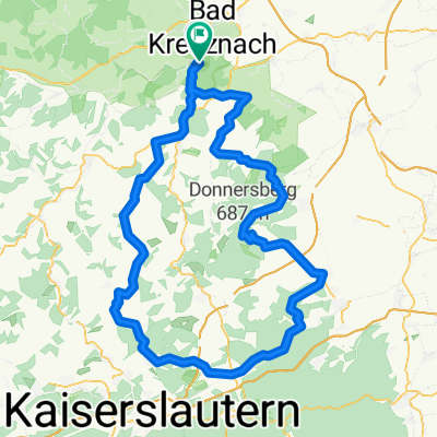
Rundroute Bad Münster, NaheRW und KleinbahnRW
A cycling route starting in Bad Münster am Stein-Ebernburg, Rhineland-Palatinate, Germany.
Overview
About this route
Beautiful and varied route, almost completely paved, with some 'highs' and 'lows' (full battery and good brakes recommended). I wouldn't take the marked detour anymore, once the bike path is free again. I rode clockwise, so that the obligatory ice cream from Vannini (at the market square in Bad Kreunach) almost marks the end.
- 3 h 34 min
- Duration
- 55.4 km
- Distance
- 725 m
- Ascent
- 775 m
- Descent
- 15.5 km/h
- Avg. speed
- 403 m
- Max. altitude
Route quality
Waytypes & surfaces along the route
Waytypes
Track
19.9 km
(36 %)
Road
8.9 km
(16 %)
Surfaces
Paved
39.9 km
(72 %)
Unpaved
6.1 km
(11 %)
Asphalt
36.6 km
(66 %)
Gravel
5 km
(9 %)
Route highlights
Points of interest along the route
Point of interest after 32.7 km
Der deutlich angenehmer verlaufende Radweg war gesperrt, die Umleitung ging "etwas" bergauf..
Point of interest after 36.5 km
Ende der Umleitung
Continue with Bikemap
Use, edit, or download this cycling route
You would like to ride Rundroute Bad Münster, NaheRW und KleinbahnRW or customize it for your own trip? Here is what you can do with this Bikemap route:
Free features
- Save this route as favorite or in collections
- Copy & plan your own version of this route
- Sync your route with Garmin or Wahoo
Premium features
Free trial for 3 days, or one-time payment. More about Bikemap Premium.
- Navigate this route on iOS & Android
- Export a GPX / KML file of this route
- Create your custom printout (try it for free)
- Download this route for offline navigation
Discover more Premium features.
Get Bikemap PremiumFrom our community
Other popular routes starting in Bad Münster am Stein-Ebernburg
 Zur Alsenz, Bad Kreuznach nach Bad Kreuznach, Bad Kreuznach
- Distance
- 6.7 km
- Ascent
- 56 m
- Descent
- 66 m
- Location
- Bad Münster am Stein-Ebernburg, Rhineland-Palatinate, Germany
 4TT26 C3 Donnersberg
- Distance
- 86.3 km
- Ascent
- 1,439 m
- Descent
- 1,440 m
- Location
- Bad Münster am Stein-Ebernburg, Rhineland-Palatinate, Germany
 4TT26 C1 Stromberg
- Distance
- 75.6 km
- Ascent
- 1,253 m
- Descent
- 1,254 m
- Location
- Bad Münster am Stein-Ebernburg, Rhineland-Palatinate, Germany
 4TT26 E2 Hunsrück
- Distance
- 139.2 km
- Ascent
- 2,448 m
- Descent
- 2,447 m
- Location
- Bad Münster am Stein-Ebernburg, Rhineland-Palatinate, Germany
 4TT26 C4 Bingen Weinberge
- Distance
- 71.6 km
- Ascent
- 1,000 m
- Descent
- 1,002 m
- Location
- Bad Münster am Stein-Ebernburg, Rhineland-Palatinate, Germany
 4TT26 E3 Donnersberg
- Distance
- 131.8 km
- Ascent
- 2,313 m
- Descent
- 2,314 m
- Location
- Bad Münster am Stein-Ebernburg, Rhineland-Palatinate, Germany
 4TT26 E1 Soonwald
- Distance
- 103.7 km
- Ascent
- 1,804 m
- Descent
- 1,804 m
- Location
- Bad Münster am Stein-Ebernburg, Rhineland-Palatinate, Germany
 Rundroute Bad Münster, NaheRW und KleinbahnRW
- Distance
- 55.4 km
- Ascent
- 725 m
- Descent
- 775 m
- Location
- Bad Münster am Stein-Ebernburg, Rhineland-Palatinate, Germany
Open it in the app