

Rondje Utrechtse Heuvelrug vanuit Rhenen
A cycling route starting in Rhenen, Utrecht, The Netherlands.
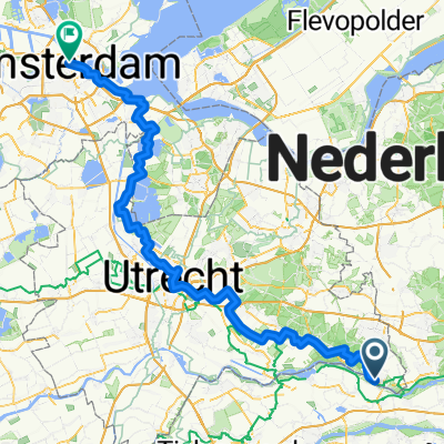
Overview
About this route
- -:--
- Duration
- 35.2 km
- Distance
- 223 m
- Ascent
- 213 m
- Descent
- ---
- Avg. speed
- 71 m
- Max. altitude
Route quality
Waytypes & surfaces along the route
Waytypes
Cycleway
14.1 km
(40 %)
Quiet road
12.3 km
(35 %)
Surfaces
Paved
20.8 km
(59 %)
Asphalt
20.8 km
(59 %)
Undefined
14.4 km
(41 %)
Continue with Bikemap
Use, edit, or download this cycling route
You would like to ride Rondje Utrechtse Heuvelrug vanuit Rhenen or customize it for your own trip? Here is what you can do with this Bikemap route:
Free features
- Save this route as favorite or in collections
- Copy & plan your own version of this route
- Sync your route with Garmin or Wahoo
Premium features
Free trial for 3 days, or one-time payment. More about Bikemap Premium.
- Navigate this route on iOS & Android
- Export a GPX / KML file of this route
- Create your custom printout (try it for free)
- Download this route for offline navigation
Discover more Premium features.
Get Bikemap PremiumFrom our community
Other popular routes starting in Rhenen
 14 Rhenen - Amsterdam
- Distance
- 112.6 km
- Ascent
- 201 m
- Descent
- 212 m
- Location
- Rhenen, Utrecht, The Netherlands
 Rhenen - N'Gein - Rhenen 2 bruggentocht
- Distance
- 95.2 km
- Ascent
- 57 m
- Descent
- 66 m
- Location
- Rhenen, Utrecht, The Netherlands
 CYCLING THE RHINE: Route R17A
- Distance
- 39.7 km
- Ascent
- 14 m
- Descent
- 30 m
- Location
- Rhenen, Utrecht, The Netherlands
 MTB 58 - Rhenen - Leersum - Amerongen
- Distance
- 58.4 km
- Ascent
- 680 m
- Descent
- 671 m
- Location
- Rhenen, Utrecht, The Netherlands
 MTBUH Verbinding Rhenen - Amerongen
- Distance
- 7 km
- Ascent
- 45 m
- Descent
- 76 m
- Location
- Rhenen, Utrecht, The Netherlands
 Vanuit Rhenen over de Utrechtse Heuvelrug
- Distance
- 37.4 km
- Ascent
- 147 m
- Descent
- 150 m
- Location
- Rhenen, Utrecht, The Netherlands
 Rhenen Mook via Andelst
- Distance
- 43.8 km
- Ascent
- 72 m
- Descent
- 77 m
- Location
- Rhenen, Utrecht, The Netherlands
 Rhenen - Mook
- Distance
- 45.4 km
- Ascent
- 14 m
- Descent
- 23 m
- Location
- Rhenen, Utrecht, The Netherlands
Open it in the app