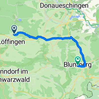
Wutachrundfahrt mit Wutach- und Schattenmühle
A cycling route starting in Löffingen, Baden-Wurttemberg, Germany.
Overview
About this route
beautiful hilly round trip with two crossings of the Wutach
- -:--
- Duration
- 46.5 km
- Distance
- 621 m
- Ascent
- 620 m
- Descent
- ---
- Avg. speed
- ---
- Max. altitude
Route highlights
Points of interest along the route
Point of interest after 0.1 km
Start an der Drei-Schluchten-Halle
Point of interest after 13.2 km
Schattenmühle (Einkehrmöglichkeit)
Point of interest after 32.3 km
Wutachmühle (mit Einkehrmöglichkeit)
Point of interest after 42.2 km
Posthaus (Einkehrmöglichkeit)
Continue with Bikemap
Use, edit, or download this cycling route
You would like to ride Wutachrundfahrt mit Wutach- und Schattenmühle or customize it for your own trip? Here is what you can do with this Bikemap route:
Free features
- Save this route as favorite or in collections
- Copy & plan your own version of this route
- Sync your route with Garmin or Wahoo
Premium features
Free trial for 3 days, or one-time payment. More about Bikemap Premium.
- Navigate this route on iOS & Android
- Export a GPX / KML file of this route
- Create your custom printout (try it for free)
- Download this route for offline navigation
Discover more Premium features.
Get Bikemap PremiumFrom our community
Other popular routes starting in Löffingen
- Schwarzwaldrunde
- Distance
- 53.4 km
- Ascent
- 734 m
- Descent
- 698 m
- Location
- Löffingen, Baden-Wurttemberg, Germany
- Wutachrundfahrt mit Wutach- und Schattenmühle
- Distance
- 46.5 km
- Ascent
- 621 m
- Descent
- 620 m
- Location
- Löffingen, Baden-Wurttemberg, Germany
- Panoramaroute
- Distance
- 43.5 km
- Ascent
- 480 m
- Descent
- 480 m
- Location
- Löffingen, Baden-Wurttemberg, Germany
- Löffingen - Möhringen
- Distance
- 52.1 km
- Ascent
- 141 m
- Descent
- 298 m
- Location
- Löffingen, Baden-Wurttemberg, Germany
- 3 Tages Biketour Südschwarzwald für MTB von H.R.S.T.
- Distance
- 120 km
- Ascent
- 1,587 m
- Descent
- 2,115 m
- Location
- Löffingen, Baden-Wurttemberg, Germany
- Rund um den Feldberg
- Distance
- 120.9 km
- Ascent
- 2,056 m
- Descent
- 2,050 m
- Location
- Löffingen, Baden-Wurttemberg, Germany
- Durch Wald und Flur zur Wallfahrtskapelle zum „Witterschneekreuz“.
- Distance
- 11.2 km
- Ascent
- 88 m
- Descent
- 88 m
- Location
- Löffingen, Baden-Wurttemberg, Germany
- Unnamed Road, Löffingen nach Florianweg 14, Bonndorf im Schwarzwald
- Distance
- 29 km
- Ascent
- 456 m
- Descent
- 516 m
- Location
- Löffingen, Baden-Wurttemberg, Germany
Open it in the app