

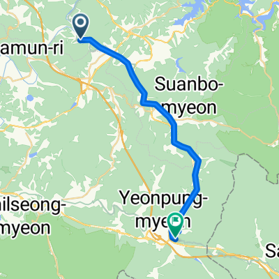
사리면 산48-1, 괴산군 ~ 증평읍 12-10, 증평군
A cycling route starting in Koesan, North Chungcheong, South Korea.
Overview
About this route
- 36 min
- Duration
- 11.1 km
- Distance
- 14 m
- Ascent
- 211 m
- Descent
- 18.5 km/h
- Avg. speed
- 249 m
- Max. altitude
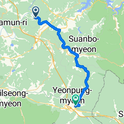
Route quality
Waytypes & surfaces along the route
Waytypes
Cycleway
6.4 km
(58 %)
Road
1.9 km
(17 %)
Surfaces
Paved
8.7 km
(79 %)
Asphalt
8.5 km
(77 %)
Concrete
0.2 km
(2 %)
Undefined
2.3 km
(21 %)
Continue with Bikemap
Use, edit, or download this cycling route
You would like to ride 사리면 산48-1, 괴산군 ~ 증평읍 12-10, 증평군 or customize it for your own trip? Here is what you can do with this Bikemap route:
Free features
- Save this route as favorite or in collections
- Copy & plan your own version of this route
- Sync your route with Garmin or Wahoo
Premium features
Free trial for 3 days, or one-time payment. More about Bikemap Premium.
- Navigate this route on iOS & Android
- Export a GPX / KML file of this route
- Create your custom printout (try it for free)
- Download this route for offline navigation
Discover more Premium features.
Get Bikemap PremiumFrom our community
Other popular routes starting in Koesan
 사리면 산48-1, 괴산군 ~ 증평읍 12-10, 증평군
- Distance
- 11.1 km
- Ascent
- 14 m
- Descent
- 211 m
- Location
- Koesan, North Chungcheong, South Korea
 Koesan - Mungyeong
- Distance
- 21.7 km
- Ascent
- 668 m
- Descent
- 446 m
- Location
- Koesan, North Chungcheong, South Korea
 1톤 월요일(메가폴리스)
- Distance
- 16.5 km
- Ascent
- 490 m
- Descent
- 518 m
- Location
- Koesan, North Chungcheong, South Korea
 Koesan - Mungyeong
- Distance
- 24.9 km
- Ascent
- 629 m
- Descent
- 439 m
- Location
- Koesan, North Chungcheong, South Korea
 2768 생활_화 (메폴>LH)
- Distance
- 18.7 km
- Ascent
- 575 m
- Descent
- 526 m
- Location
- Koesan, North Chungcheong, South Korea
 2768 생활_월,금(주덕시내,대소원,성마루)
- Distance
- 29.4 km
- Ascent
- 354 m
- Descent
- 263 m
- Location
- Koesan, North Chungcheong, South Korea
 2768 생활_수(메폴,첨단)
- Distance
- 20 km
- Ascent
- 376 m
- Descent
- 358 m
- Location
- Koesan, North Chungcheong, South Korea
 월악산 104km
- Distance
- 102.2 km
- Ascent
- 1,385 m
- Descent
- 1,380 m
- Location
- Koesan, North Chungcheong, South Korea
Open it in the app