

"Motbakken"
A cycling route starting in Lunde, Telemark, Norway.
Overview
About this route
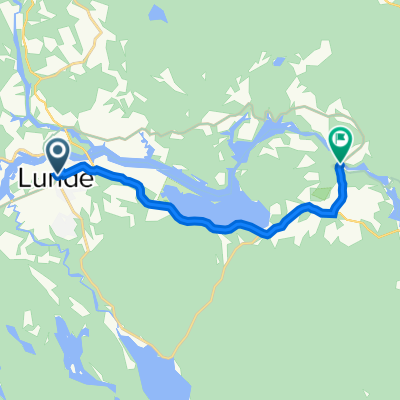
Exhausting route starting and finishing by the beautiful Canal in Telemark. 61 km of hilly roads. Make sure you bring some food and water! This course is defined as a black course which means that you will have to climb a total of 600 vertical meters or more...- and bike in different types of terrain. This specific course however, leads you out on a tour of climbing a total of 950 vertical meters. The trip will take you about 4 - 5 hours and you will get some exciting biking. Suitable for fit people! Enjoy!
- -:--
- Duration
- 60.8 km
- Distance
- 841 m
- Ascent
- 841 m
- Descent
- ---
- Avg. speed
- ---
- Max. altitude
Route quality
Waytypes & surfaces along the route
Waytypes
Quiet road
31 km
(51 %)
Access road
10.3 km
(17 %)
Surfaces
Paved
2.4 km
(4 %)
Unpaved
12.2 km
(20 %)
Gravel
11 km
(18 %)
Asphalt
2.4 km
(4 %)
Continue with Bikemap
Use, edit, or download this cycling route
You would like to ride "Motbakken" or customize it for your own trip? Here is what you can do with this Bikemap route:
Free features
- Save this route as favorite or in collections
- Copy & plan your own version of this route
- Sync your route with Garmin or Wahoo
Premium features
Free trial for 3 days, or one-time payment. More about Bikemap Premium.
- Navigate this route on iOS & Android
- Export a GPX / KML file of this route
- Create your custom printout (try it for free)
- Download this route for offline navigation
Discover more Premium features.
Get Bikemap PremiumFrom our community
Other popular routes starting in Lunde
 Telemarkskanalen Lunde-Dalen
- Distance
- 99.2 km
- Ascent
- 2,145 m
- Descent
- 2,182 m
- Location
- Lunde, Telemark, Norway
 Lunde
Lunde- Distance
- 6.7 km
- Ascent
- 107 m
- Descent
- 105 m
- Location
- Lunde, Telemark, Norway
 04 Lunde - Strond
- Distance
- 52.8 km
- Ascent
- 1,176 m
- Descent
- 984 m
- Location
- Lunde, Telemark, Norway
 "Motbakken"
- Distance
- 60.8 km
- Ascent
- 841 m
- Descent
- 841 m
- Location
- Lunde, Telemark, Norway
 Telemarkskanal og setesdal 2020
- Distance
- 326.7 km
- Ascent
- 1,274 m
- Descent
- 1,338 m
- Location
- Lunde, Telemark, Norway
 Bø-Lunde lille rundtur
- Distance
- 53.2 km
- Ascent
- 938 m
- Descent
- 938 m
- Location
- Lunde, Telemark, Norway
 Lunde-Spjotsodd
- Distance
- 48.1 km
- Ascent
- 422 m
- Descent
- 418 m
- Location
- Lunde, Telemark, Norway
 Lunde til Vrangfoss
- Distance
- 7.6 km
- Ascent
- 83 m
- Descent
- 114 m
- Location
- Lunde, Telemark, Norway
Open it in the app