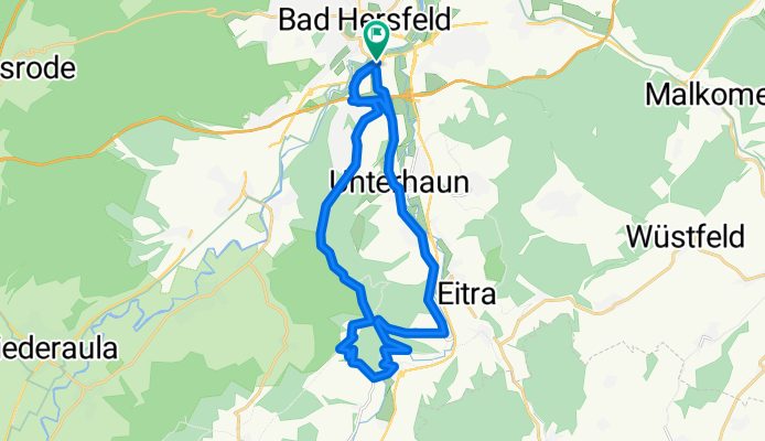
Bad Hersfeld -> Siegwinden und zurück
A cycling route starting in Bad Hersfeld, Hesse, Germany.
Overview
About this route
Die Route kann sowohl von Anfängern als auch von Fortgeschrittenen gefahren werden. Von Bad Hersfeld bis nach Siegwinden geht es fast ausschließlich Berg-Auf.
Die Strecke ist abwechslungsreich und bietet viele Möglichkeiten dies auszubauen und das in alle Himmelsrichtungen.
Es sind ca. 60% Asphalt- und 40% Waldstrecke.
- -:--
- Duration
- 25.1 km
- Distance
- 441 m
- Ascent
- 438 m
- Descent
- ---
- Avg. speed
- ---
- Max. altitude
Route highlights
Points of interest along the route
Point of interest after 8.3 km
Ist ein kleines nettes Feriendomiziel mit Fussballplatz und mehr
Continue with Bikemap
Use, edit, or download this cycling route
You would like to ride Bad Hersfeld -> Siegwinden und zurück or customize it for your own trip? Here is what you can do with this Bikemap route:
Free features
- Save this route as favorite or in collections
- Copy & plan your own version of this route
- Sync your route with Garmin or Wahoo
Premium features
Free trial for 3 days, or one-time payment. More about Bikemap Premium.
- Navigate this route on iOS & Android
- Export a GPX / KML file of this route
- Create your custom printout (try it for free)
- Download this route for offline navigation
Discover more Premium features.
Get Bikemap PremiumFrom our community
Other popular routes starting in Bad Hersfeld
 Seulingswald1
- Distance
- 51 km
- Ascent
- 536 m
- Descent
- 536 m
- Location
- Bad Hersfeld, Hesse, Germany
 08.BRH.Phil.-Fulda
- Distance
- 99.1 km
- Ascent
- 912 m
- Descent
- 851 m
- Location
- Bad Hersfeld, Hesse, Germany
 Seulingswald2
- Distance
- 26 km
- Ascent
- 333 m
- Descent
- 333 m
- Location
- Bad Hersfeld, Hesse, Germany
 Westlicher Seulingswald
- Distance
- 7.8 km
- Ascent
- 217 m
- Descent
- 54 m
- Location
- Bad Hersfeld, Hesse, Germany
 Kleine Runde im Fuldatal
- Distance
- 40.9 km
- Ascent
- 153 m
- Descent
- 154 m
- Location
- Bad Hersfeld, Hesse, Germany
 Auqa Fit HEF- Solztalradweg -Schenklengsfeld - HEF
- Distance
- 27.3 km
- Ascent
- 325 m
- Descent
- 325 m
- Location
- Bad Hersfeld, Hesse, Germany
 De Glockenstraße 14, Bad Hersfeld a Glockenstraße 14, Bad Hersfeld
- Distance
- 15.9 km
- Ascent
- 255 m
- Descent
- 307 m
- Location
- Bad Hersfeld, Hesse, Germany
 BahnRadweg Hessen
- Distance
- 311.2 km
- Ascent
- 1,339 m
- Descent
- 971 m
- Location
- Bad Hersfeld, Hesse, Germany
Open it in the app

