

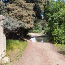
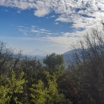
codegua/autodromo/tres caminos
A cycling route starting in Graneros, O'Higgins Region, Chile.
Overview
About this route
- 1 h 21 min
- Duration
- 27.7 km
- Distance
- 192 m
- Ascent
- 220 m
- Descent
- 20.5 km/h
- Avg. speed
- 605 m
- Max. altitude
Route quality
Waytypes & surfaces along the route
Waytypes
Road
10.8 km
(39 %)
Cycleway
6.7 km
(24 %)
Surfaces
Paved
18.3 km
(66 %)
Unpaved
2.8 km
(10 %)
Paved (undefined)
8.9 km
(32 %)
Asphalt
5.5 km
(20 %)
Continue with Bikemap
Use, edit, or download this cycling route
You would like to ride codegua/autodromo/tres caminos or customize it for your own trip? Here is what you can do with this Bikemap route:
Free features
- Save this route as favorite or in collections
- Copy & plan your own version of this route
- Sync your route with Garmin or Wahoo
Premium features
Free trial for 3 days, or one-time payment. More about Bikemap Premium.
- Navigate this route on iOS & Android
- Export a GPX / KML file of this route
- Create your custom printout (try it for free)
- Download this route for offline navigation
Discover more Premium features.
Get Bikemap PremiumFrom our community
Other popular routes starting in Graneros
 Paseo tranquilo
- Distance
- 27.6 km
- Ascent
- 232 m
- Descent
- 254 m
- Location
- Graneros, O'Higgins Region, Chile
 gros/piuchen/la leonera/gros
- Distance
- 19.8 km
- Ascent
- 299 m
- Descent
- 49 m
- Location
- Graneros, O'Higgins Region, Chile
 gros/medialuna/antenas/piuchen/codegua/gros
- Distance
- 50.3 km
- Ascent
- 531 m
- Descent
- 555 m
- Location
- Graneros, O'Higgins Region, Chile
 reconocimento ant. norte sur
- Distance
- 35.1 km
- Ascent
- 924 m
- Descent
- 950 m
- Location
- Graneros, O'Higgins Region, Chile
 gros/san joaqui/leonera/codegua/gros
- Distance
- 55.3 km
- Ascent
- 293 m
- Descent
- 321 m
- Location
- Graneros, O'Higgins Region, Chile
 calentamiento con sol
- Distance
- 32.6 km
- Ascent
- 319 m
- Descent
- 348 m
- Location
- Graneros, O'Higgins Region, Chile
 el bolson/gros
- Distance
- 21 km
- Ascent
- 29 m
- Descent
- 331 m
- Location
- Graneros, O'Higgins Region, Chile
 gros/camino los maquis/antenas/gros
- Distance
- 34.3 km
- Ascent
- 479 m
- Descent
- 507 m
- Location
- Graneros, O'Higgins Region, Chile
Open it in the app