

12.05.26 Seen-Rundfahrt im Münchner Süden
A cycling route starting in Icking, Bavaria, Germany.
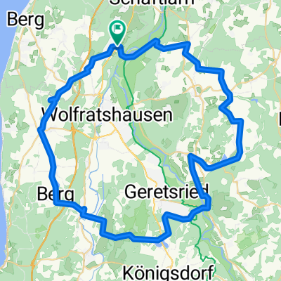
Overview
About this route
Über Königsdorfer Alm.
Start- u. Zielpunkt S-Bahnhof Icking.
Zwei knackige Anstiege bei Hornstein und nach Eurasburg (man kann auch das Rad schieben), daher auch für Mountainbike geeignet. Sonst leicht hügelig bzw. eben auf Schotterwegen u. geteerten Nebenstraßen. Reichlich Bade- u. Einkehrmöglichkeiten am Wegesrand.
Nette gemütliche Tagestour.
- -:--
- Duration
- 54.1 km
- Distance
- 448 m
- Ascent
- 448 m
- Descent
- ---
- Avg. speed
- ---
- Max. altitude

Route quality
Waytypes & surfaces along the route
Waytypes
Quiet road
23.6 km
(44 %)
Road
11.9 km
(22 %)
Surfaces
Paved
42.7 km
(79 %)
Unpaved
9.5 km
(18 %)
Asphalt
39.3 km
(73 %)
Gravel
7.8 km
(14 %)
Route highlights
Points of interest along the route
Accommodation after 35.2 km
Kaffeepause
Accommodation after 47.3 km
Trinkpause
Continue with Bikemap
Use, edit, or download this cycling route
You would like to ride 12.05.26 Seen-Rundfahrt im Münchner Süden or customize it for your own trip? Here is what you can do with this Bikemap route:
Free features
- Save this route as favorite or in collections
- Copy & plan your own version of this route
- Sync your route with Garmin or Wahoo
Premium features
Free trial for 3 days, or one-time payment. More about Bikemap Premium.
- Navigate this route on iOS & Android
- Export a GPX / KML file of this route
- Create your custom printout (try it for free)
- Download this route for offline navigation
Discover more Premium features.
Get Bikemap PremiumFrom our community
Other popular routes starting in Icking
 12.05.26 Seen-Rundfahrt im Münchner Süden
- Distance
- 54.1 km
- Ascent
- 448 m
- Descent
- 448 m
- Location
- Icking, Bavaria, Germany
 11.08.20 Seen-Rundfahrt im Münchner Süden
- Distance
- 64.1 km
- Ascent
- 462 m
- Descent
- 462 m
- Location
- Icking, Bavaria, Germany
 Fahrradtour_4-4_April2019
- Distance
- 38.1 km
- Ascent
- 154 m
- Descent
- 256 m
- Location
- Icking, Bavaria, Germany
 Moderate Route in Icking
- Distance
- 74.7 km
- Ascent
- 499 m
- Descent
- 483 m
- Location
- Icking, Bavaria, Germany
 Unnamed Road, Berg nach Schwaige 6, Starnberg
- Distance
- 8 km
- Ascent
- 16 m
- Descent
- 138 m
- Location
- Icking, Bavaria, Germany
 Irschenhausen-Jachenau
- Distance
- 125.1 km
- Ascent
- 663 m
- Descent
- 645 m
- Location
- Icking, Bavaria, Germany
 StarnbergerSee-KlosterSchäftlarn
- Distance
- 54.9 km
- Ascent
- 404 m
- Descent
- 403 m
- Location
- Icking, Bavaria, Germany
 Route ab Icking
- Distance
- 49.7 km
- Ascent
- 516 m
- Descent
- 604 m
- Location
- Icking, Bavaria, Germany
Open it in the app