

Ruta del Pantano y Robledales . Cervera de Pisuerga
A cycling route starting in Cervera de Pisuerga, Castille and León, Spain.
Overview
About this route
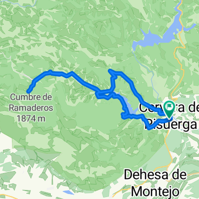
La salida de Cervera por la senda de Peña Barrio hasta el Mirador de Las Matas por el km4. Se baja a Rebanal por pista. Se pasa por Vergaño. Después se va ascendiendo (es larga y dura) hasta el collado de la Muñeca (1330m), que es un bosque de robles. Para entrar en el valle de Castilleria por el GR1, se pasa por diferentes pueblos hasta llegar al parquin del Roblón de Estalalla, árbol catalogado. Se sigue por el GR1 bordeando el pantano de Requejada, hasta el pueblo de Arbejal. Después se asciende a Piedras Negras, para iniciar un divertido sendero hasta Cervera.
- -:--
- Duration
- 52.1 km
- Distance
- 1,693 m
- Ascent
- 1,694 m
- Descent
- ---
- Avg. speed
- 1,338 m
- Max. altitude
Route quality
Waytypes & surfaces along the route
Waytypes
Track
29.8 km
(57 %)
Path
15.7 km
(30 %)
Surfaces
Paved
3.2 km
(6 %)
Unpaved
30.7 km
(59 %)
Ground
13.3 km
(26 %)
Gravel
9.8 km
(19 %)
Continue with Bikemap
Use, edit, or download this cycling route
You would like to ride Ruta del Pantano y Robledales . Cervera de Pisuerga or customize it for your own trip? Here is what you can do with this Bikemap route:
Free features
- Save this route as favorite or in collections
- Copy & plan your own version of this route
- Sync your route with Garmin or Wahoo
Premium features
Free trial for 3 days, or one-time payment. More about Bikemap Premium.
- Navigate this route on iOS & Android
- Export a GPX / KML file of this route
- Create your custom printout (try it for free)
- Download this route for offline navigation
Discover more Premium features.
Get Bikemap PremiumFrom our community
Other popular routes starting in Cervera de Pisuerga
 Ruta pantanos. Montaña palentina. Cervera-Cervera
- Distance
- 97 km
- Ascent
- 727 m
- Descent
- 708 m
- Location
- Cervera de Pisuerga, Castille and León, Spain
 Despoblado de Frontada
- Distance
- 23 km
- Ascent
- 132 m
- Descent
- 169 m
- Location
- Cervera de Pisuerga, Castille and León, Spain
 cervera-vidrieros-puertos de riofrio-ledantes
- Distance
- 56.6 km
- Ascent
- 1,059 m
- Descent
- 1,262 m
- Location
- Cervera de Pisuerga, Castille and León, Spain
 Etapa 1 . Vuelta a la Montaña Palentina . Cervera/Camasobres
- Distance
- 46.7 km
- Ascent
- 1,451 m
- Descent
- 1,261 m
- Location
- Cervera de Pisuerga, Castille and León, Spain
 Fuente Deshondonada
- Distance
- 31.2 km
- Ascent
- 320 m
- Descent
- 320 m
- Location
- Cervera de Pisuerga, Castille and León, Spain
 Tag 4 von Cervera de Pisuera nach Mediana de Pomar
- Distance
- 112.7 km
- Ascent
- 634 m
- Descent
- 1,055 m
- Location
- Cervera de Pisuerga, Castille and León, Spain
 Lechetronica 2013
- Distance
- 163.7 km
- Ascent
- 0 m
- Descent
- 0 m
- Location
- Cervera de Pisuerga, Castille and León, Spain
 Cervera de pisuerga
- Distance
- 103.7 km
- Ascent
- 1,058 m
- Descent
- 1,062 m
- Location
- Cervera de Pisuerga, Castille and León, Spain
Open it in the app