

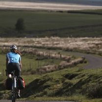
Hadrian's Cycleway Adventure
Hadrian's Cycleway - NCN 72
A cycling route starting in Seascale, England, United Kingdom.
Overview
About this route
I have created this route, as I found the GPX download from Sustrans (NCN 72) to be lacking in some places. Or maybe this is connected how Bikemap imports it, I am not sure. Anyway, this is "my" version of it, going along the NCN 72.
- 17 h 27 min
- Duration
- 276.4 km
- Distance
- 1,745 m
- Ascent
- 1,734 m
- Descent
- 15.8 km/h
- Avg. speed
- 262 m
- Max. altitude

Part of
Hadrian's Cycleway Adventure
1 stage
Route quality
Waytypes & surfaces along the route
Waytypes
Quiet road
85.7 km
(31 %)
Cycleway
80.2 km
(29 %)
Surfaces
Paved
82.9 km
(30 %)
Unpaved
2.8 km
(1 %)
Asphalt
71.9 km
(26 %)
Paved (undefined)
8.3 km
(3 %)
Route highlights
Points of interest along the route
Point of interest after 0 km
Muncaster Castle
Point of interest after 0 km
Glannaventa Roman Bath House
Accommodation after 70.8 km
4, Marine Terrace
Accommodation after 131.4 km
Premier Inn Carlisle Central
Continue with Bikemap
Use, edit, or download this cycling route
You would like to ride Hadrian's Cycleway - NCN 72 or customize it for your own trip? Here is what you can do with this Bikemap route:
Free features
- Save this route as favorite or in collections
- Copy & plan your own version of this route
- Split it into stages to create a multi-day tour
- Sync your route with Garmin or Wahoo
Premium features
Free trial for 3 days, or one-time payment. More about Bikemap Premium.
- Navigate this route on iOS & Android
- Export a GPX / KML file of this route
- Create your custom printout (try it for free)
- Download this route for offline navigation
Discover more Premium features.
Get Bikemap PremiumFrom our community
Other popular routes starting in Seascale
 Seascale Cycling in the wonderful Lake District
- Distance
- 52.9 km
- Ascent
- 640 m
- Descent
- 478 m
- Location
- Seascale, England, United Kingdom
 HardKnott Pass
- Distance
- 31.8 km
- Ascent
- 575 m
- Descent
- 575 m
- Location
- Seascale, England, United Kingdom
 Hadrian's Way
- Distance
- 237.5 km
- Ascent
- 598 m
- Descent
- 596 m
- Location
- Seascale, England, United Kingdom
 Hadrians Wall Cycle Route 2011
- Distance
- 288.5 km
- Ascent
- 567 m
- Descent
- 563 m
- Location
- Seascale, England, United Kingdom
 Hadrian's Cycleway - NCN 72
- Distance
- 276.4 km
- Ascent
- 1,745 m
- Descent
- 1,734 m
- Location
- Seascale, England, United Kingdom
 C2C-No-ferry
- Distance
- 242.2 km
- Ascent
- 691 m
- Descent
- 691 m
- Location
- Seascale, England, United Kingdom
 coast 2 coast 2014
- Distance
- 237.7 km
- Ascent
- 1,415 m
- Descent
- 1,386 m
- Location
- Seascale, England, United Kingdom
 Hadrian's Wall Day 1: Ravenglass to Maryport
- Distance
- 59.3 km
- Ascent
- 537 m
- Descent
- 524 m
- Location
- Seascale, England, United Kingdom
Open it in the app