

Grenzlandradweg Aigen-Bad Leonfelden-Linz
A cycling route starting in Aigen im Mühlkreis, Upper Austria, Austria.
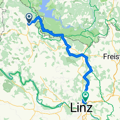
Overview
About this route
Mit der Mühlkreisbahn nach Aigen (p.P. € 9,- zzgl. Rad 5 €, Preise 05/2012). Der Grenzlandwanderweg ist vorbildlich mit einem informativem grünen Wegweiser mit der Nummer R5 ausgeschildert. Der Weg bietet ein abwechslungsreiches Bergauf und Bergab in beschaulich-bezaubernder Landschaft begleitet von meditativen Naturklängen samt Vogel, Wind und Grille.
Einkehrmöglichkeiten: Jimmy´s Pizza | Gasthof Ghali Hörleinsödt 23, 4170 Haslach Hotel Guglwald, Guglwald 8, 4191 Vorderweißenbach Konditorei Kastner, Hauptplatz 26, 4190 Bad Leonfelden Pelmbergstüberl, Pelmberg 2, 4202 Hellmonsödt Wia z’haus Lehner, Harbacher Straße 38, 4040 Linz- -:--
- Duration
- 84.1 km
- Distance
- 1,101 m
- Ascent
- 1,385 m
- Descent
- ---
- Avg. speed
- ---
- Avg. speed

Route quality
Waytypes & surfaces along the route
Waytypes
Road
36.7 km
(44 %)
Quiet road
31.6 km
(38 %)
Surfaces
Paved
39.1 km
(46 %)
Unpaved
15.3 km
(18 %)
Asphalt
39 km
(46 %)
Ground
9.7 km
(12 %)
Continue with Bikemap
Use, edit, or download this cycling route
You would like to ride Grenzlandradweg Aigen-Bad Leonfelden-Linz or customize it for your own trip? Here is what you can do with this Bikemap route:
Free features
- Save this route as favorite or in collections
- Copy & plan your own version of this route
- Split it into stages to create a multi-day tour
- Sync your route with Garmin or Wahoo
Premium features
Free trial for 3 days, or one-time payment. More about Bikemap Premium.
- Navigate this route on iOS & Android
- Export a GPX / KML file of this route
- Create your custom printout (try it for free)
- Download this route for offline navigation
Discover more Premium features.
Get Bikemap PremiumFrom our community
Other popular routes starting in Aigen im Mühlkreis
 Aigen - Kirchbach - St. Wolfgang - Aigen
- Distance
- 15.7 km
- Ascent
- 427 m
- Descent
- 430 m
- Location
- Aigen im Mühlkreis, Upper Austria, Austria
 Aigen - St. Thomas - Lipno
- Distance
- 60.6 km
- Ascent
- 676 m
- Descent
- 676 m
- Location
- Aigen im Mühlkreis, Upper Austria, Austria
 Aigen Schlägel - Lipno - Linz
- Distance
- 144.3 km
- Ascent
- 781 m
- Descent
- 1,078 m
- Location
- Aigen im Mühlkreis, Upper Austria, Austria
 802 Sonnenwald
- Distance
- 24.2 km
- Ascent
- 330 m
- Descent
- 331 m
- Location
- Aigen im Mühlkreis, Upper Austria, Austria
 Krakau Heimweg 6
- Distance
- 185.3 km
- Ascent
- 6,498 m
- Descent
- 6,691 m
- Location
- Aigen im Mühlkreis, Upper Austria, Austria
 Mühlviertel bis Linz
- Distance
- 74.2 km
- Ascent
- 1,188 m
- Descent
- 1,161 m
- Location
- Aigen im Mühlkreis, Upper Austria, Austria
 RCR: Frühjahrstour 18 II MTB
- Distance
- 115.5 km
- Ascent
- 892 m
- Descent
- 1,404 m
- Location
- Aigen im Mühlkreis, Upper Austria, Austria
 Gründwaldrunde ca. 8,5km, 300Hm
- Distance
- 8.8 km
- Ascent
- 338 m
- Descent
- 336 m
- Location
- Aigen im Mühlkreis, Upper Austria, Austria
Open it in the app