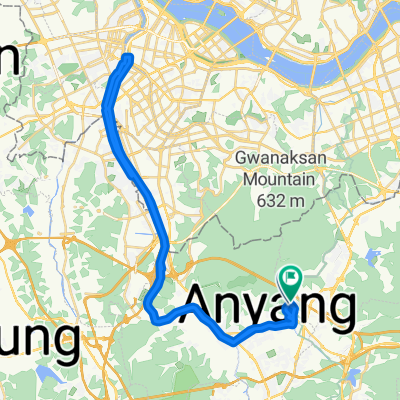
편안한 경로
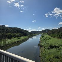
A cycling route starting in Anyang-si, Gyeonggi-do, South Korea.
Overview
About this route
- 36 min
- Duration
- 10.2 km
- Distance
- 19 m
- Ascent
- 64 m
- Descent
- 17.1 km/h
- Avg. speed
- 95 m
- Max. altitude
Continue with Bikemap
Use, edit, or download this cycling route
You would like to ride 편안한 경로 or customize it for your own trip? Here is what you can do with this Bikemap route:
Free features
- Save this route as favorite or in collections
- Copy & plan your own version of this route
- Sync your route with Garmin or Wahoo
Premium features
Free trial for 3 days, or one-time payment. More about Bikemap Premium.
- Navigate this route on iOS & Android
- Export a GPX / KML file of this route
- Create your custom printout (try it for free)
- Download this route for offline navigation
Discover more Premium features.
Get Bikemap PremiumFrom our community
Other popular routes starting in Anyang-si
- 산본동, 군포시에서 산본동, 군포시까지
- Distance
- 15.4 km
- Ascent
- 212 m
- Descent
- 186 m
- Location
- Anyang-si, Gyeonggi-do, South Korea
- 안정적인 라이딩
- Distance
- 47 km
- Ascent
- 215 m
- Descent
- 221 m
- Location
- Anyang-si, Gyeonggi-do, South Korea
- 쌍개울-광진교-마포대교
- Distance
- 89.4 km
- Ascent
- 258 m
- Descent
- 242 m
- Location
- Anyang-si, Gyeonggi-do, South Korea
- 안양 - 소레포구
- Distance
- 33.2 km
- Ascent
- 325 m
- Descent
- 344 m
- Location
- Anyang-si, Gyeonggi-do, South Korea
- 내손동, 의왕시 to 638, 포일동, 의왕시
- Distance
- 4.8 km
- Ascent
- 20 m
- Descent
- 23 m
- Location
- Anyang-si, Gyeonggi-do, South Korea
- 쌍개울(안양) To 초계국수집(하남)
- Distance
- 100.8 km
- Ascent
- 66 m
- Descent
- 57 m
- Location
- Anyang-si, Gyeonggi-do, South Korea
- 쌍개울(안양)To오이도역(시흥)
- Distance
- 54.7 km
- Ascent
- 85 m
- Descent
- 115 m
- Location
- Anyang-si, Gyeonggi-do, South Korea
- 2023.09.02
- Distance
- 48.3 km
- Ascent
- 130 m
- Descent
- 163 m
- Location
- Anyang-si, Gyeonggi-do, South Korea
Open it in the app