

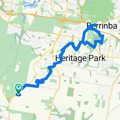
190 Carter Rd, Munruben to 190 Carter Rd, Munruben
A cycling route starting in Park Ridge South, Queensland, Australia.
Overview
About this route
- 54 min
- Duration
- 26.1 km
- Distance
- 245 m
- Ascent
- 244 m
- Descent
- 29 km/h
- Avg. speed
- 81 m
- Max. altitude

Route quality
Waytypes & surfaces along the route
Waytypes
Quiet road
14.1 km
(54 %)
Cycleway
8.1 km
(31 %)
Surfaces
Paved
20.1 km
(77 %)
Asphalt
20.1 km
(77 %)
Undefined
6 km
(23 %)
Continue with Bikemap
Use, edit, or download this cycling route
You would like to ride 190 Carter Rd, Munruben to 190 Carter Rd, Munruben or customize it for your own trip? Here is what you can do with this Bikemap route:
Free features
- Save this route as favorite or in collections
- Copy & plan your own version of this route
- Sync your route with Garmin or Wahoo
Premium features
Free trial for 3 days, or one-time payment. More about Bikemap Premium.
- Navigate this route on iOS & Android
- Export a GPX / KML file of this route
- Create your custom printout (try it for free)
- Download this route for offline navigation
Discover more Premium features.
Get Bikemap PremiumFrom our community
Other popular routes starting in Park Ridge South
 East West Route Logan
- Distance
- 19.6 km
- Ascent
- 82 m
- Descent
- 148 m
- Location
- Park Ridge South, Queensland, Australia
 Guroman Dr, Greenbank to 15 Pub La, Greenbank
- Distance
- 10.3 km
- Ascent
- 75 m
- Descent
- 65 m
- Location
- Park Ridge South, Queensland, Australia
 24–38 Compal Rd, Park Ridge to 67 Mannington Rd, Acacia Ridge
- Distance
- 24.7 km
- Ascent
- 291 m
- Descent
- 306 m
- Location
- Park Ridge South, Queensland, Australia
 Indica Crescent 28, Regents Park to Beaudesert Road 1377, Acacia Ridge
- Distance
- 13.4 km
- Ascent
- 126 m
- Descent
- 131 m
- Location
- Park Ridge South, Queensland, Australia
 Middle Rd, Greenbank to Middle Rd, Greenbank
- Distance
- 35.8 km
- Ascent
- 224 m
- Descent
- 224 m
- Location
- Park Ridge South, Queensland, Australia
 644 Middle Rd, Greenbank to 644 Middle Rd, Greenbank
- Distance
- 18.8 km
- Ascent
- 161 m
- Descent
- 164 m
- Location
- Park Ridge South, Queensland, Australia
 184 Andrew Rd, Greenbank to 644 Middle Rd, Greenbank
- Distance
- 12 km
- Ascent
- 91 m
- Descent
- 101 m
- Location
- Park Ridge South, Queensland, Australia
 Indica Crescent 23, Regents Park to Grey Street 230, South Brisbane
- Distance
- 28 km
- Ascent
- 254 m
- Descent
- 280 m
- Location
- Park Ridge South, Queensland, Australia
Open it in the app