
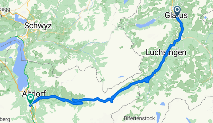
Overview
About this route
- 5 h 6 min
- Duration
- 65.7 km
- Distance
- 2,338 m
- Ascent
- 2,326 m
- Descent
- 12.9 km/h
- Avg. speed
- 1,959 m
- Max. altitude
Part of
2025_ALPX
8 stages
Route quality
Waytypes & surfaces along the route
Waytypes
Quiet road
9.2 km
(14 %)
Track
5.3 km
(8 %)
Surfaces
Paved
51.9 km
(79 %)
Unpaved
4.6 km
(7 %)
Asphalt
51.9 km
(79 %)
Loose gravel
2.6 km
(4 %)
Route highlights
Points of interest along the route
Drinking water after 8.9 km
Drinking water after 9.6 km
Drinking water after 11.8 km
Drinking water after 12.8 km
Drinking water after 14.7 km
Bike service after 15.3 km
Ladestation
Drinking water after 24.6 km
Bike service after 29.6 km
Ladestation
Drinking water after 30.3 km
Drinking water after 37.1 km
Bike service after 38.5 km
Ladestation
Drinking water after 38.6 km
Drinking water after 43.5 km
Drinking water after 48.5 km
Drinking water after 55.9 km
Drinking water after 61.9 km
Continue with Bikemap
Use, edit, or download this cycling route
You would like to ride V2_E02_ALPX_Schweiz or customize it for your own trip? Here is what you can do with this Bikemap route:
Free features
- Save this route as favorite or in collections
- Copy & plan your own version of this route
- Sync your route with Garmin or Wahoo
Premium features
Free trial for 3 days, or one-time payment. More about Bikemap Premium.
- Navigate this route on iOS & Android
- Export a GPX / KML file of this route
- Create your custom printout (try it for free)
- Download this route for offline navigation
Discover more Premium features.
Get Bikemap PremiumFrom our community
Other popular routes starting in Glarus
 Transalp 2014 - T3
- Distance
- 74.9 km
- Ascent
- 2,094 m
- Descent
- 1,908 m
- Location
- Glarus, Canton of Glarus, Switzerland
 Klausenpass / Pragelpass
- Distance
- 128.8 km
- Ascent
- 2,578 m
- Descent
- 2,578 m
- Location
- Glarus, Canton of Glarus, Switzerland
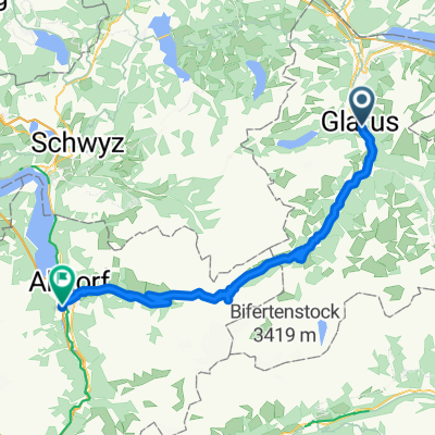 V2_E02_ALPX_Schweiz
- Distance
- 65.7 km
- Ascent
- 2,338 m
- Descent
- 2,326 m
- Location
- Glarus, Canton of Glarus, Switzerland
 Oli+Cle Radtour mit Kindern - 2. Etappe
- Distance
- 41.5 km
- Ascent
- 996 m
- Descent
- 1,191 m
- Location
- Glarus, Canton of Glarus, Switzerland
 Day III: Glarus to Lustenau
- Distance
- 106.1 km
- Ascent
- 126 m
- Descent
- 196 m
- Location
- Glarus, Canton of Glarus, Switzerland
 Etappe-8
- Distance
- 137.8 km
- Ascent
- 2,721 m
- Descent
- 2,768 m
- Location
- Glarus, Canton of Glarus, Switzerland
 Lurigenstrasse 9, Glarus nach Poststrasse 14, Glarus Süd
- Distance
- 18.9 km
- Ascent
- 321 m
- Descent
- 172 m
- Location
- Glarus, Canton of Glarus, Switzerland
 Pragelpass
- Distance
- 39.9 km
- Ascent
- 1,408 m
- Descent
- 1,461 m
- Location
- Glarus, Canton of Glarus, Switzerland
Open it in the app