

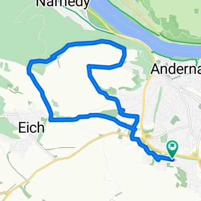
TBAB MTB Feierabendrunde
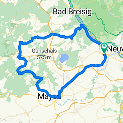
A cycling route starting in Andernach, Rhineland-Palatinate, Germany.
Overview
About this route
Gemütliche kleine Feierabendrunde mit drei Abfahrten:
1.) ein kleiner Wurzeltrail-Downhill im Wald vom Hochkreuz zum kleinen Stern (Reitweg, Einstieg vom Waldweg aus links- kurz bevor man den Wald verlässt)
2.) vom kleinen Stern aus Waldautobahn am Grat entlang zum Sendemast am Kranenberg
3.) vom Feldweg aus durch den oberen Hohlweg am Margarethenhof vorbei zum Kirchberg, durchs Wohngebiet (Galileihof), Jump über den Deubach nicht vergessen! ;-)
- -:--
- Duration
- 11.9 km
- Distance
- 230 m
- Ascent
- 218 m
- Descent
- ---
- Avg. speed
- 323 m
- Max. altitude

Route quality
Waytypes & surfaces along the route
Waytypes
Track
4.9 km
(41 %)
Path
3 km
(26 %)
Surfaces
Paved
3.6 km
(30 %)
Unpaved
7.4 km
(62 %)
Gravel
4.8 km
(40 %)
Asphalt
2 km
(17 %)
Route highlights
Points of interest along the route
Point of interest after 5.3 km
Start Abfahrt 1: "Wurzeltrail"
Point of interest after 5.5 km
Start Abfahrt 2: "Kleiner Stern"
Point of interest after 7.4 km
Sendemast auf dem Kranenberg
Point of interest after 8.5 km
Start Abfahrt 3: "oberer Hohlweg"
Point of interest after 10.5 km
Jump über den Deubach
Continue with Bikemap
Use, edit, or download this cycling route
You would like to ride TBAB MTB Feierabendrunde or customize it for your own trip? Here is what you can do with this Bikemap route:
Free features
- Save this route as favorite or in collections
- Copy & plan your own version of this route
- Sync your route with Garmin or Wahoo
Premium features
Free trial for 3 days, or one-time payment. More about Bikemap Premium.
- Navigate this route on iOS & Android
- Export a GPX / KML file of this route
- Create your custom printout (try it for free)
- Download this route for offline navigation
Discover more Premium features.
Get Bikemap PremiumFrom our community
Other popular routes starting in Andernach
 Andernach bis Köln
- Distance
- 79.5 km
- Ascent
- 300 m
- Descent
- 316 m
- Location
- Andernach, Rhineland-Palatinate, Germany
 Nettetal 2013 - 75 km Permanente des Rad Club Albatros 1924 e.V. Andernach
- Distance
- 72.5 km
- Ascent
- 560 m
- Descent
- 560 m
- Location
- Andernach, Rhineland-Palatinate, Germany
 2016 - 5. Tag
- Distance
- 102.9 km
- Ascent
- 125 m
- Descent
- 145 m
- Location
- Andernach, Rhineland-Palatinate, Germany
 Antel 121, Andernach nach Heerstraße 43–47, Sankt Goar
- Distance
- 64.6 km
- Ascent
- 358 m
- Descent
- 422 m
- Location
- Andernach, Rhineland-Palatinate, Germany
 TBAB MTB Feierabendrunde
- Distance
- 11.9 km
- Ascent
- 230 m
- Descent
- 218 m
- Location
- Andernach, Rhineland-Palatinate, Germany
 Kirchstraße 33, Andernach nach Uferstraße 5, Andernach
- Distance
- 46.8 km
- Ascent
- 351 m
- Descent
- 364 m
- Location
- Andernach, Rhineland-Palatinate, Germany
 Andernach - Koblenz25km - (Lahnmündung+8km) - Andernach
- Distance
- 65.8 km
- Ascent
- 33 m
- Descent
- 34 m
- Location
- Andernach, Rhineland-Palatinate, Germany
 Rund um Andernach 2011 - RTF des Rad Club Albatros 1924 e.V. Andernach - 73 km Strecke
- Distance
- 72 km
- Ascent
- 416 m
- Descent
- 416 m
- Location
- Andernach, Rhineland-Palatinate, Germany
Open it in the app