

19.05.12 - Rund um den Schöckl
A cycling route starting in Fernitz, Styria, Austria.
Overview
About this route
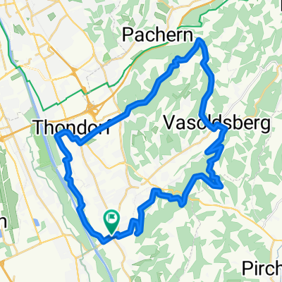
Climb from Peggau to Jägerwirt From Fernitz on the Mur bike path north to Peggau, where the categorized climb begins up to Semrich, a wonderfully solitary route with partially beautiful views! This is followed by a short descent to Semrich, then it climbs again up to Jägerwirt, with a constant view of the Schöckl. At the Schöcklkreuz the highest point of the day is reached, followed by a long descent through Radegund and Fasslberg back to Fernitz. Traffic volume is mostly very low to almost non-existent.
- -:--
- Duration
- 95.9 km
- Distance
- 1,010 m
- Ascent
- 1,010 m
- Descent
- ---
- Avg. speed
- ---
- Max. altitude

Continue with Bikemap
Use, edit, or download this cycling route
You would like to ride 19.05.12 - Rund um den Schöckl or customize it for your own trip? Here is what you can do with this Bikemap route:
Free features
- Save this route as favorite or in collections
- Copy & plan your own version of this route
- Split it into stages to create a multi-day tour
- Sync your route with Garmin or Wahoo
Premium features
Free trial for 3 days, or one-time payment. More about Bikemap Premium.
- Navigate this route on iOS & Android
- Export a GPX / KML file of this route
- Create your custom printout (try it for free)
- Download this route for offline navigation
Discover more Premium features.
Get Bikemap PremiumFrom our community
Other popular routes starting in Fernitz
 Hügelige Runde - Apfelstrasse - Kulm
- Distance
- 115 km
- Ascent
- 2,067 m
- Descent
- 1,988 m
- Location
- Fernitz, Styria, Austria
 27.06.10 - Kirschen tour rund um Gleisdorf
- Distance
- 98.4 km
- Ascent
- 1,083 m
- Descent
- 1,083 m
- Location
- Fernitz, Styria, Austria
 Badgamser Panoramastraße
- Distance
- 82.7 km
- Ascent
- 952 m
- Descent
- 951 m
- Location
- Fernitz, Styria, Austria
 1.5.10 - Durchs Blütenmeer der Apfelstrasse - Kulm
- Distance
- 116.9 km
- Ascent
- 1,203 m
- Descent
- 1,203 m
- Location
- Fernitz, Styria, Austria
 fernitz-hühnerberg-schloss waasen-kollisch-werndorf-kalsdorf-fernitz
- Distance
- 30.6 km
- Ascent
- 254 m
- Descent
- 253 m
- Location
- Fernitz, Styria, Austria
 Wolfsgrabenrunde
- Distance
- 32.3 km
- Ascent
- 411 m
- Descent
- 410 m
- Location
- Fernitz, Styria, Austria
 19.02.11 - MTB - Mellachberg
- Distance
- 13.1 km
- Ascent
- 335 m
- Descent
- 331 m
- Location
- Fernitz, Styria, Austria
 7.4.10 - MTB Extra - Plabutsch - Florianiberg
- Distance
- 46.2 km
- Ascent
- 569 m
- Descent
- 570 m
- Location
- Fernitz, Styria, Austria
Open it in the app