

Cyklokarpaty 2009 Przemyśl - Mega
A cycling route starting in Przemyśl, Subcarpathian Voivodeship, Poland.
Overview
About this route
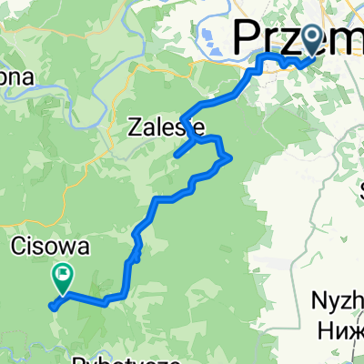
REM II Mountain Bike Marathon Route - Przemyśl Fortress 2009. Mega Distance.
- -:--
- Duration
- 34.8 km
- Distance
- 741 m
- Ascent
- 631 m
- Descent
- ---
- Avg. speed
- 421 m
- Max. altitude

Route quality
Waytypes & surfaces along the route
Waytypes
Track
13.9 km
(40 %)
Quiet road
7 km
(20 %)
Surfaces
Paved
18.8 km
(54 %)
Unpaved
3.1 km
(9 %)
Asphalt
12.2 km
(35 %)
Paved (undefined)
6.3 km
(18 %)
Route highlights
Points of interest along the route
Point of interest after 4.5 km
Start ostry.
Point of interest after 5.2 km
Rozjazd Hobby i Mega, Giga.
Point of interest after 21.9 km
Bufet.
Point of interest after 28.7 km
Rozjazd Mega i Giga.
Continue with Bikemap
Use, edit, or download this cycling route
You would like to ride Cyklokarpaty 2009 Przemyśl - Mega or customize it for your own trip? Here is what you can do with this Bikemap route:
Free features
- Save this route as favorite or in collections
- Copy & plan your own version of this route
- Sync your route with Garmin or Wahoo
Premium features
Free trial for 3 days, or one-time payment. More about Bikemap Premium.
- Navigate this route on iOS & Android
- Export a GPX / KML file of this route
- Create your custom printout (try it for free)
- Download this route for offline navigation
Discover more Premium features.
Get Bikemap PremiumFrom our community
Other popular routes starting in Przemyśl
 Trasa rowerowa po fortach Twierdzy Przemyśl - cz. południowa
- Distance
- 51.7 km
- Ascent
- 545 m
- Descent
- 545 m
- Location
- Przemyśl, Subcarpathian Voivodeship, Poland
 BIES - KIDY 2016.07
- Distance
- 570.4 km
- Ascent
- 1,675 m
- Descent
- 1,721 m
- Location
- Przemyśl, Subcarpathian Voivodeship, Poland
 Gen. Prądzyńskiego 26, Przemyśl do Marcina Bielskiego 66, Przemyśl
- Distance
- 34.7 km
- Ascent
- 1,608 m
- Descent
- 1,632 m
- Location
- Przemyśl, Subcarpathian Voivodeship, Poland
 Ignacego Prądzyńskiego 21, Przemyśl do Gen. Prądzyńskiego 23, Przemyśl
- Distance
- 21.3 km
- Ascent
- 657 m
- Descent
- 653 m
- Location
- Przemyśl, Subcarpathian Voivodeship, Poland
 49.779, 22.759 do 49.684, 22.606
- Distance
- 27.8 km
- Ascent
- 736 m
- Descent
- 450 m
- Location
- Przemyśl, Subcarpathian Voivodeship, Poland
 Wokół Polski Wschód1
- Distance
- 671.5 km
- Ascent
- 2,930 m
- Descent
- 2,980 m
- Location
- Przemyśl, Subcarpathian Voivodeship, Poland
 Pętla Arłamowska
- Distance
- 82.4 km
- Ascent
- 1,402 m
- Descent
- 1,341 m
- Location
- Przemyśl, Subcarpathian Voivodeship, Poland
 Kalwaria Pacławska- dwa koła
- Distance
- 52.4 km
- Ascent
- 507 m
- Descent
- 521 m
- Location
- Przemyśl, Subcarpathian Voivodeship, Poland
Open it in the app