
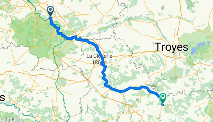
17 Rue Paul Doumer, Melun to 30 Rue de l'Hôpital, Tonnerre
A cycling route starting in Melun, Île-de-France Region, France.
Overview
About this route
- 12 h 9 min
- Duration
- 174.2 km
- Distance
- 531 m
- Ascent
- 433 m
- Descent
- 14.3 km/h
- Avg. speed
- 157 m
- Max. altitude
Route quality
Waytypes & surfaces along the route
Waytypes
Quiet road
49.2 km
(28 %)
Track
40.9 km
(23 %)
Surfaces
Paved
94.7 km
(54 %)
Unpaved
28.5 km
(16 %)
Asphalt
86.8 km
(50 %)
Gravel
14.1 km
(8 %)
Continue with Bikemap
Use, edit, or download this cycling route
You would like to ride 17 Rue Paul Doumer, Melun to 30 Rue de l'Hôpital, Tonnerre or customize it for your own trip? Here is what you can do with this Bikemap route:
Free features
- Save this route as favorite or in collections
- Copy & plan your own version of this route
- Split it into stages to create a multi-day tour
- Sync your route with Garmin or Wahoo
Premium features
Free trial for 3 days, or one-time payment. More about Bikemap Premium.
- Navigate this route on iOS & Android
- Export a GPX / KML file of this route
- Create your custom printout (try it for free)
- Download this route for offline navigation
Discover more Premium features.
Get Bikemap PremiumFrom our community
Other popular routes starting in Melun
 Tour de France 2017 Stage 21
- Distance
- 112.7 km
- Ascent
- 264 m
- Descent
- 248 m
- Location
- Melun, Île-de-France Region, France
 Melun Buthiers
- Distance
- 40.9 km
- Ascent
- 316 m
- Descent
- 293 m
- Location
- Melun, Île-de-France Region, France
 Week-end 1er mai 2015
- Distance
- 28.2 km
- Ascent
- 105 m
- Descent
- 101 m
- Location
- Melun, Île-de-France Region, France
 17 Rue Paul Doumer, Melun to 30 Rue de l'Hôpital, Tonnerre
- Distance
- 174.2 km
- Ascent
- 531 m
- Descent
- 433 m
- Location
- Melun, Île-de-France Region, France
 Gros Débiles Tour
- Distance
- 577.7 km
- Ascent
- 1,111 m
- Descent
- 1,002 m
- Location
- Melun, Île-de-France Region, France
 la balade
- Distance
- 499.6 km
- Ascent
- 1,603 m
- Descent
- 1,202 m
- Location
- Melun, Île-de-France Region, France
 Untitled route
- Distance
- 1,017.7 km
- Ascent
- 6,109 m
- Descent
- 6,026 m
- Location
- Melun, Île-de-France Region, France
 Challenge du Tourmagne - 1-Melun-ChatillonSurLoire - 2-ChatillonSurLoire-Nevers - 3-Nevers-Charroux - 4-Charroux-ClermontFerrand - 5-ClermontFerrand-Massiac ...
- Distance
- 991.7 km
- Ascent
- 902 m
- Descent
- 823 m
- Location
- Melun, Île-de-France Region, France
Open it in the app