

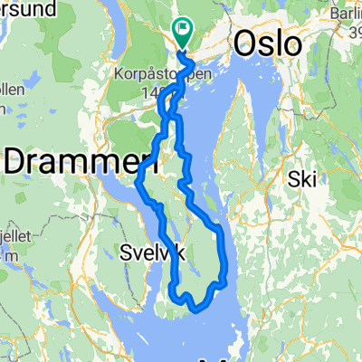
Kolsås stasjon - Krokkleiva
A cycling route starting in Sandvika, Akershus, Norway.
Overview
About this route
- 1 h 29 min
- Duration
- 20.2 km
- Distance
- 542 m
- Ascent
- 225 m
- Descent
- 13.6 km/h
- Avg. speed
- 438 m
- Max. altitude

Route quality
Waytypes & surfaces along the route
Waytypes
Quiet road
15.2 km
(75 %)
Cycleway
2.8 km
(14 %)
Surfaces
Paved
2.2 km
(11 %)
Unpaved
1.2 km
(6 %)
Asphalt
2.2 km
(11 %)
Loose gravel
0.8 km
(4 %)
Continue with Bikemap
Use, edit, or download this cycling route
You would like to ride Kolsås stasjon - Krokkleiva or customize it for your own trip? Here is what you can do with this Bikemap route:
Free features
- Save this route as favorite or in collections
- Copy & plan your own version of this route
- Sync your route with Garmin or Wahoo
Premium features
Free trial for 3 days, or one-time payment. More about Bikemap Premium.
- Navigate this route on iOS & Android
- Export a GPX / KML file of this route
- Create your custom printout (try it for free)
- Download this route for offline navigation
Discover more Premium features.
Get Bikemap PremiumFrom our community
Other popular routes starting in Sandvika
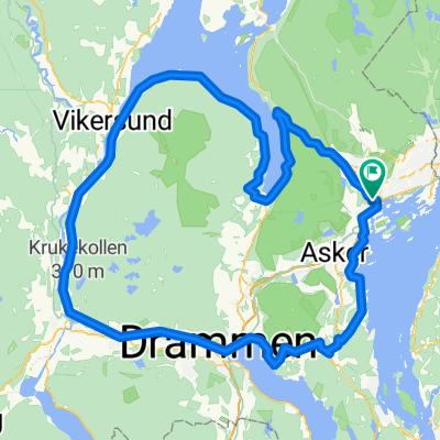
 Tyrifjorden Rundt
- Distance
- 149.8 km
- Ascent
- 956 m
- Descent
- 956 m
- Location
- Sandvika, Akershus, Norway
 Slemmestad - Heggedal - Dikemark - Asker
- Distance
- 48.2 km
- Ascent
- 455 m
- Descent
- 454 m
- Location
- Sandvika, Akershus, Norway
 Askerrunde fra Sandvika
- Distance
- 61.3 km
- Ascent
- 625 m
- Descent
- 625 m
- Location
- Sandvika, Akershus, Norway
 TRO2016 - 2.pinsedag
- Distance
- 118 km
- Ascent
- 909 m
- Descent
- 909 m
- Location
- Sandvika, Akershus, Norway
 Claude Monets alle, Sandvika to Claude Monets alle, Sandvika
- Distance
- 107.6 km
- Ascent
- 1,744 m
- Descent
- 1,747 m
- Location
- Sandvika, Akershus, Norway
 kolsås til dikemark rundt
- Distance
- 50.7 km
- Ascent
- 897 m
- Descent
- 890 m
- Location
- Sandvika, Akershus, Norway
 Hurumlandet fra Sandvika
- Distance
- 72.1 km
- Ascent
- 619 m
- Descent
- 617 m
- Location
- Sandvika, Akershus, Norway
 Treningsrunden via Eiker og Sylling
- Distance
- 144.6 km
- Ascent
- 722 m
- Descent
- 723 m
- Location
- Sandvika, Akershus, Norway
Open it in the app