

Quer durchs Salzkammergut
A cycling route starting in Aurach am Hongar, Upper Austria, Austria.
Overview
About this route
Total duration of the tour is about 12h with about 1.5h of rest. We got lost once during the tour and ended up at Großer Sonnstein, which meant about 350hm more....
Downhill to 90% on trails (including downhill track from Feuerkogel to the avalanche slope, then hiking path)
Breaks taken at Feuerkogel, Hochsteinalm and Hongar.
- -:--
- Duration
- 88.5 km
- Distance
- 2,476 m
- Ascent
- 2,477 m
- Descent
- ---
- Avg. speed
- ---
- Max. altitude
Continue with Bikemap
Use, edit, or download this cycling route
You would like to ride Quer durchs Salzkammergut or customize it for your own trip? Here is what you can do with this Bikemap route:
Free features
- Save this route as favorite or in collections
- Copy & plan your own version of this route
- Split it into stages to create a multi-day tour
- Sync your route with Garmin or Wahoo
Premium features
Free trial for 3 days, or one-time payment. More about Bikemap Premium.
- Navigate this route on iOS & Android
- Export a GPX / KML file of this route
- Create your custom printout (try it for free)
- Download this route for offline navigation
Discover more Premium features.
Get Bikemap PremiumFrom our community
Other popular routes starting in Aurach am Hongar
 Route nach B120 2, Gmunden
- Distance
- 14.9 km
- Ascent
- 361 m
- Descent
- 725 m
- Location
- Aurach am Hongar, Upper Austria, Austria
 Quer durchs Salzkammergut
- Distance
- 88.5 km
- Ascent
- 2,476 m
- Descent
- 2,477 m
- Location
- Aurach am Hongar, Upper Austria, Austria
 Fisch Lambach Waldweg
- Distance
- 38.8 km
- Ascent
- 596 m
- Descent
- 689 m
- Location
- Aurach am Hongar, Upper Austria, Austria
 Grünau im almtal
- Distance
- 87.1 km
- Ascent
- 637 m
- Descent
- 643 m
- Location
- Aurach am Hongar, Upper Austria, Austria
 Quer durchs Salzkammergut CLONED FROM ROUTE 1601634
- Distance
- 85.5 km
- Ascent
- 2,532 m
- Descent
- 2,532 m
- Location
- Aurach am Hongar, Upper Austria, Austria
 Runde Ruthenmoos - Hinterbuch - Wankham
- Distance
- 11 km
- Ascent
- 118 m
- Descent
- 117 m
- Location
- Aurach am Hongar, Upper Austria, Austria
 Hongar
- Distance
- 16.3 km
- Ascent
- 447 m
- Descent
- 423 m
- Location
- Aurach am Hongar, Upper Austria, Austria
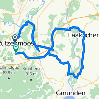 Laakirchen Runde
- Distance
- 36.3 km
- Ascent
- 495 m
- Descent
- 577 m
- Location
- Aurach am Hongar, Upper Austria, Austria
Open it in the app