

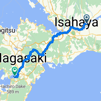
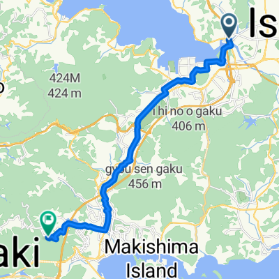
Day 523-1
A cycling route starting in Isahaya, Nagasaki, Japan.
Overview
About this route
- -:--
- Duration
- 47.4 km
- Distance
- 67 m
- Ascent
- 99 m
- Descent
- ---
- Avg. speed
- 35 m
- Max. altitude

Continue with Bikemap
Use, edit, or download this cycling route
You would like to ride Day 523-1 or customize it for your own trip? Here is what you can do with this Bikemap route:
Free features
- Save this route as favorite or in collections
- Copy & plan your own version of this route
- Sync your route with Garmin or Wahoo
Premium features
Free trial for 3 days, or one-time payment. More about Bikemap Premium.
- Navigate this route on iOS & Android
- Export a GPX / KML file of this route
- Create your custom printout (try it for free)
- Download this route for offline navigation
Discover more Premium features.
Get Bikemap PremiumFrom our community
Other popular routes starting in Isahaya
 諫早-東大村
- Distance
- 37 km
- Ascent
- 691 m
- Descent
- 695 m
- Location
- Isahaya, Nagasaki, Japan
 Day 523-1
- Distance
- 47.4 km
- Ascent
- 67 m
- Descent
- 99 m
- Location
- Isahaya, Nagasaki, Japan
 諫早市多良見町
- Distance
- 10.2 km
- Ascent
- 110 m
- Descent
- 168 m
- Location
- Isahaya, Nagasaki, Japan
 諫早市 to 鹿島市
- Distance
- 22.9 km
- Ascent
- 367 m
- Descent
- 357 m
- Location
- Isahaya, Nagasaki, Japan
 諫早ー東長崎(右周り)
- Distance
- 40.5 km
- Ascent
- 576 m
- Descent
- 573 m
- Location
- Isahaya, Nagasaki, Japan
 走った道
走った道- Distance
- 76.4 km
- Ascent
- 447 m
- Descent
- 444 m
- Location
- Isahaya, Nagasaki, Japan
 Isahaya - Nagasaki
- Distance
- 40.7 km
- Ascent
- 1,129 m
- Descent
- 1,121 m
- Location
- Isahaya, Nagasaki, Japan
 Ōmura to Yahazu
- Distance
- 17.1 km
- Ascent
- 331 m
- Descent
- 110 m
- Location
- Isahaya, Nagasaki, Japan
Open it in the app