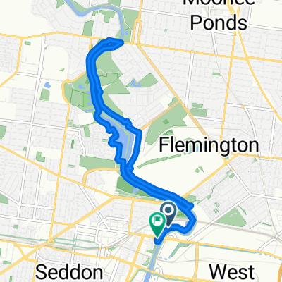
Footscray to City / Capitol
A cycling route starting in Footscray, Victoria, Australia.
Overview
About this route
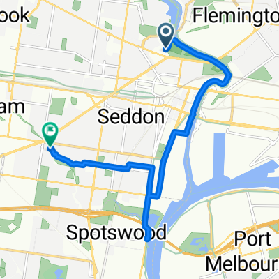
Footscray to thru lloyd st, up arden... this is my ride to work but also good general route to city. If I'm heading to Carlton/Fitzroy/Collingwood, I generally follow queensberry the whole way.. or go to the top of arden and then down grattan st past the hospitals
Note: Travels through Lloyd St Business Park. When travelling West (from city), the gate is sometimes locked. Use code 4570 to get through.
- 34 min
- Duration
- 8.5 km
- Distance
- 101 m
- Ascent
- 88 m
- Descent
- 14.9 km/h
- Avg. speed
- 61 m
- Avg. speed
Route quality
Waytypes & surfaces along the route
Waytypes
Quiet road
3.7 km
(44 %)
Road
3.2 km
(37 %)
Surfaces
Paved
8.2 km
(97 %)
Asphalt
7.5 km
(88 %)
Paved (undefined)
0.6 km
(7 %)
Route highlights
Points of interest along the route
Point of interest after 3.9 km
lloyd st business park dm me for the code
Continue with Bikemap
Use, edit, or download this cycling route
You would like to ride Footscray to City / Capitol or customize it for your own trip? Here is what you can do with this Bikemap route:
Free features
- Save this route as favorite or in collections
- Copy & plan your own version of this route
- Sync your route with Garmin or Wahoo
Premium features
Free trial for 3 days, or one-time payment. More about Bikemap Premium.
- Navigate this route on iOS & Android
- Export a GPX / KML file of this route
- Create your custom printout (try it for free)
- Download this route for offline navigation
Discover more Premium features.
Get Bikemap PremiumFrom our community
Other popular routes starting in Footscray
- Footscray to Brunswick / upfield bike path
- Distance
- 7.8 km
- Ascent
- 61 m
- Descent
- 37 m
- Location
- Footscray, Victoria, Australia
- Footscray to City / Capitol
- Distance
- 8.5 km
- Ascent
- 101 m
- Descent
- 88 m
- Location
- Footscray, Victoria, Australia
- Norwest Loop
- Distance
- 35.7 km
- Ascent
- 185 m
- Descent
- 185 m
- Location
- Footscray, Victoria, Australia
- Footscray to Cremorne
- Distance
- 11.5 km
- Ascent
- 108 m
- Descent
- 110 m
- Location
- Footscray, Victoria, Australia
- Nornorwest Rivers Circuit
- Distance
- 48.9 km
- Ascent
- 219 m
- Descent
- 219 m
- Location
- Footscray, Victoria, Australia
- Merri Creek/Upfield Trail
- Distance
- 54.3 km
- Ascent
- 1,242 m
- Descent
- 1,232 m
- Location
- Footscray, Victoria, Australia
- city loop with divert to Williamstown
- Distance
- 30.2 km
- Ascent
- 1,306 m
- Descent
- 1,299 m
- Location
- Footscray, Victoria, Australia
- Spred Out Sunday Course In Footscray
- Distance
- 15.5 km
- Ascent
- 112 m
- Descent
- 121 m
- Location
- Footscray, Victoria, Australia
Open it in the app