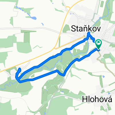
Osvarčín - Hlohová- Kanice
A cycling route starting in Staňkov, Plzeň Region, Czechia.
Overview
About this route
The more information you write here, the more useful it will be for other users.<br /><br />* Route details.<br />* What is special about this route?<br />* Why would you recommend this route?<br />* What did you like most here?<br />* Etc.
- -:--
- Duration
- 29.8 km
- Distance
- 329 m
- Ascent
- 261 m
- Descent
- ---
- Avg. speed
- ---
- Max. altitude
Route quality
Waytypes & surfaces along the route
Waytypes
Road
20.6 km
(69 %)
Track
1.2 km
(4 %)
Surfaces
Paved
7.2 km
(24 %)
Unpaved
1.2 km
(4 %)
Asphalt
7.2 km
(24 %)
Ground
1.2 km
(4 %)
Undefined
21.5 km
(72 %)
Continue with Bikemap
Use, edit, or download this cycling route
You would like to ride Osvarčín - Hlohová- Kanice or customize it for your own trip? Here is what you can do with this Bikemap route:
Free features
- Save this route as favorite or in collections
- Copy & plan your own version of this route
- Sync your route with Garmin or Wahoo
Premium features
Free trial for 3 days, or one-time payment. More about Bikemap Premium.
- Navigate this route on iOS & Android
- Export a GPX / KML file of this route
- Create your custom printout (try it for free)
- Download this route for offline navigation
Discover more Premium features.
Get Bikemap PremiumFrom our community
Other popular routes starting in Staňkov
- Koloveč - Stod přes Vytůň - rozhledna Vrabinec - Merklín - Koloveč
- Distance
- 47.4 km
- Ascent
- 472 m
- Descent
- 498 m
- Location
- Staňkov, Plzeň Region, Czechia
- Supersonic route in Mestys Stankov
- Distance
- 7.3 km
- Ascent
- 29 m
- Descent
- 26 m
- Location
- Staňkov, Plzeň Region, Czechia
- A7 Stankov to Praha
- Distance
- 139.1 km
- Ascent
- 642 m
- Descent
- 802 m
- Location
- Staňkov, Plzeň Region, Czechia
- Osvarčín - Hlohová- Kanice
- Distance
- 29.8 km
- Ascent
- 329 m
- Descent
- 261 m
- Location
- Staňkov, Plzeň Region, Czechia
- Koloveč - Domažlice - Česká Kubice - Mlýneček - Kdyně - Němčice - Koloveč
- Distance
- 60.7 km
- Ascent
- 819 m
- Descent
- 811 m
- Location
- Staňkov, Plzeň Region, Czechia
- Koloveč - Klatovy - Velhartice - Kolínec - Plánice - Klatovy - Koloveč
- Distance
- 98.7 km
- Ascent
- 687 m
- Descent
- 683 m
- Location
- Staňkov, Plzeň Region, Czechia
- 2014_04_26 Staňkov-Vejprnice
- Distance
- 42.9 km
- Ascent
- 446 m
- Descent
- 472 m
- Location
- Staňkov, Plzeň Region, Czechia
- Koloveč - Plánice - Nepomuk - Zelená Hora - Přeštice - Merklín - Koloveč
- Distance
- 107.2 km
- Ascent
- 1,269 m
- Descent
- 1,305 m
- Location
- Staňkov, Plzeň Region, Czechia
Open it in the app