

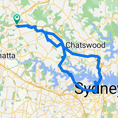
Carlingford-Parramatta-Olympic Park-Glebe-Harbour Bridge-Chatswood-Macquarie Park-Epping Loop
A cycling route starting in West Pennant Hills, New South Wales, Australia.
Overview
About this route
- 5 h 1 min
- Duration
- 74.2 km
- Distance
- 944 m
- Ascent
- 943 m
- Descent
- 14.8 km/h
- Avg. speed
- 132 m
- Max. altitude
Route quality
Waytypes & surfaces along the route
Waytypes
Cycleway
34.9 km
(47 %)
Quiet road
26.7 km
(36 %)
Surfaces
Paved
65.3 km
(88 %)
Asphalt
31.9 km
(43 %)
Concrete
17.1 km
(23 %)
Continue with Bikemap
Use, edit, or download this cycling route
You would like to ride Carlingford-Parramatta-Olympic Park-Glebe-Harbour Bridge-Chatswood-Macquarie Park-Epping Loop or customize it for your own trip? Here is what you can do with this Bikemap route:
Free features
- Save this route as favorite or in collections
- Copy & plan your own version of this route
- Sync your route with Garmin or Wahoo
Premium features
Free trial for 3 days, or one-time payment. More about Bikemap Premium.
- Navigate this route on iOS & Android
- Export a GPX / KML file of this route
- Create your custom printout (try it for free)
- Download this route for offline navigation
Discover more Premium features.
Get Bikemap PremiumFrom our community
Other popular routes starting in West Pennant Hills
 Epic Route
- Distance
- 235.2 km
- Ascent
- 2,514 m
- Descent
- 2,515 m
- Location
- West Pennant Hills, New South Wales, Australia
 Carlingford-City loop via Pittwater
- Distance
- 57.2 km
- Ascent
- 837 m
- Descent
- 836 m
- Location
- West Pennant Hills, New South Wales, Australia
 Carlingford to Manly
- Distance
- 44.6 km
- Ascent
- 698 m
- Descent
- 799 m
- Location
- West Pennant Hills, New South Wales, Australia
 Route to Timbertop Avenue, Carlingford, NSW, 2118
- Distance
- 53.1 km
- Ascent
- 502 m
- Descent
- 501 m
- Location
- West Pennant Hills, New South Wales, Australia
 West Pennant Hills and Castle Hill
- Distance
- 19.4 km
- Ascent
- 273 m
- Descent
- 273 m
- Location
- West Pennant Hills, New South Wales, Australia
 Carlingford-Westmead-Parramatta-Harris Park-Olympic Park-Eastwood-Epping Loop
- Distance
- 40.7 km
- Ascent
- 406 m
- Descent
- 405 m
- Location
- West Pennant Hills, New South Wales, Australia
 Carlingford-Parramatta-Olympic Park-Glebe-Harbour Bridge-Chatswood-Macquarie Park-Epping Loop
- Distance
- 74.2 km
- Ascent
- 944 m
- Descent
- 943 m
- Location
- West Pennant Hills, New South Wales, Australia
 WPH to Cheltenham
- Distance
- 13.6 km
- Ascent
- 199 m
- Descent
- 199 m
- Location
- West Pennant Hills, New South Wales, Australia
Open it in the app