

Sweet Tee’s Coffee Shop
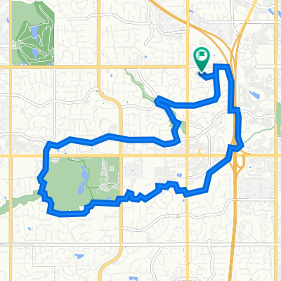
A cycling route starting in Lenexa, Kansas, United States of America.
Overview
About this route
- 1 h 2 min
- Duration
- 17.9 km
- Distance
- 174 m
- Ascent
- 152 m
- Descent
- 17.4 km/h
- Avg. speed
- 332 m
- Max. altitude
Route quality
Waytypes & surfaces along the route
Waytypes
Cycleway
10.8 km
(60 %)
Quiet road
4.4 km
(25 %)
Surfaces
Paved
13.7 km
(76 %)
Asphalt
12.1 km
(68 %)
Concrete
1.4 km
(8 %)
Continue with Bikemap
Use, edit, or download this cycling route
You would like to ride Sweet Tee’s Coffee Shop or customize it for your own trip? Here is what you can do with this Bikemap route:
Free features
- Save this route as favorite or in collections
- Copy & plan your own version of this route
- Sync your route with Garmin or Wahoo
Premium features
Free trial for 3 days, or one-time payment. More about Bikemap Premium.
- Navigate this route on iOS & Android
- Export a GPX / KML file of this route
- Create your custom printout (try it for free)
- Download this route for offline navigation
Discover more Premium features.
Get Bikemap PremiumFrom our community
Other popular routes starting in Lenexa
 Pilgrim Coffee Co.
- Distance
- 30.6 km
- Ascent
- 244 m
- Descent
- 258 m
- Location
- Lenexa, Kansas, United States of America
 Modified Bike Source Ride
- Distance
- 62 km
- Ascent
- 191 m
- Descent
- 184 m
- Location
- Lenexa, Kansas, United States of America
 Station 3 Coffee Shop
- Distance
- 8.5 km
- Ascent
- 68 m
- Descent
- 121 m
- Location
- Lenexa, Kansas, United States of America
 Tomahawk Trail West Loop
- Distance
- 14.1 km
- Ascent
- 114 m
- Descent
- 114 m
- Location
- Lenexa, Kansas, United States of America
 6822 W 132nd Terr, Overland Park to 6822 W 132nd Terr, Overland Park
- Distance
- 39.8 km
- Ascent
- 282 m
- Descent
- 282 m
- Location
- Lenexa, Kansas, United States of America
 Sweet Tee’s Coffee Shop
- Distance
- 17.9 km
- Ascent
- 174 m
- Descent
- 152 m
- Location
- Lenexa, Kansas, United States of America
 17.95 mi starting at Woodland park
- Distance
- 29.9 km
- Ascent
- 179 m
- Descent
- 180 m
- Location
- Lenexa, Kansas, United States of America
 POUR Coffeehouse
- Distance
- 12 km
- Ascent
- 143 m
- Descent
- 132 m
- Location
- Lenexa, Kansas, United States of America
Open it in the app