

capo/paspardo/capo
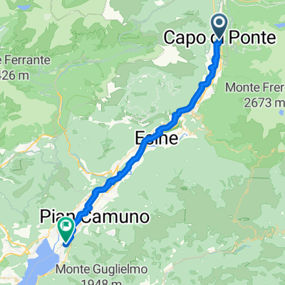
A cycling route starting in Capo di Ponte, Lombardy, Italy.
Overview
About this route
In the straight section between Capo di Ponte and Paspardo, there is a map bug at one point. I didn't use the magnet there, but the road exists and is paved.
- -:--
- Duration
- 18.8 km
- Distance
- 653 m
- Ascent
- 655 m
- Descent
- ---
- Avg. speed
- ---
- Max. altitude

Route quality
Waytypes & surfaces along the route
Waytypes
Road
8.1 km
(43 %)
Quiet road
1.3 km
(7 %)
Surfaces
Paved
8.8 km
(47 %)
Asphalt
8.8 km
(47 %)
Undefined
10 km
(53 %)
Continue with Bikemap
Use, edit, or download this cycling route
You would like to ride capo/paspardo/capo or customize it for your own trip? Here is what you can do with this Bikemap route:
Free features
- Save this route as favorite or in collections
- Copy & plan your own version of this route
- Sync your route with Garmin or Wahoo
Premium features
Free trial for 3 days, or one-time payment. More about Bikemap Premium.
- Navigate this route on iOS & Android
- Export a GPX / KML file of this route
- Create your custom printout (try it for free)
- Download this route for offline navigation
Discover more Premium features.
Get Bikemap PremiumFrom our community
Other popular routes starting in Capo di Ponte
 capo di ponte pisogne vello
- Distance
- 42.5 km
- Ascent
- 342 m
- Descent
- 519 m
- Location
- Capo di Ponte, Lombardy, Italy
 capo di ponte Iseo
- Distance
- 60.8 km
- Ascent
- 122 m
- Descent
- 300 m
- Location
- Capo di Ponte, Lombardy, Italy
 day 4
day 4- Distance
- 161.2 km
- Ascent
- 1,340 m
- Descent
- 1,439 m
- Location
- Capo di Ponte, Lombardy, Italy
 Capo di Ponte - Pisogne
- Distance
- 37.8 km
- Ascent
- 17 m
- Descent
- 201 m
- Location
- Capo di Ponte, Lombardy, Italy
 Versuch aufs Rifugio de Maria
- Distance
- 24 km
- Ascent
- 1,010 m
- Descent
- 1,006 m
- Location
- Capo di Ponte, Lombardy, Italy
 20 Sept - to Iseo-F
- Distance
- 61.3 km
- Ascent
- 252 m
- Descent
- 446 m
- Location
- Capo di Ponte, Lombardy, Italy
 capo/paspardo/capo
- Distance
- 18.8 km
- Ascent
- 653 m
- Descent
- 655 m
- Location
- Capo di Ponte, Lombardy, Italy
 Capo di Ponte - Nadro -Cimbergo - Rifugio Volano de Marie
- Distance
- 26.7 km
- Ascent
- 1,075 m
- Descent
- 1,073 m
- Location
- Capo di Ponte, Lombardy, Italy
Open it in the app