

Day14_Ayt Takla to Zimran al-Sharqiyyah
A cycling route starting in Tabia, Tadla-Azilal, Morocco.
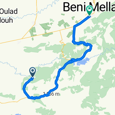
Overview
About this route
- 6 h 26 min
- Duration
- 100.7 km
- Distance
- 864 m
- Ascent
- 977 m
- Descent
- 15.6 km/h
- Avg. speed
- 1,124 m
- Avg. speed

Route quality
Waytypes & surfaces along the route
Waytypes
Busy road
44 km
(44 %)
Road
27.6 km
(27 %)
Surfaces
Paved
63.8 km
(63 %)
Unpaved
0.9 km
(<1 %)
Asphalt
63.6 km
(63 %)
Unpaved (undefined)
0.9 km
(<1 %)
Continue with Bikemap
Use, edit, or download this cycling route
You would like to ride Day14_Ayt Takla to Zimran al-Sharqiyyah or customize it for your own trip? Here is what you can do with this Bikemap route:
Free features
- Save this route as favorite or in collections
- Copy & plan your own version of this route
- Sync your route with Garmin or Wahoo
Premium features
Free trial for 3 days, or one-time payment. More about Bikemap Premium.
- Navigate this route on iOS & Android
- Export a GPX / KML file of this route
- Create your custom printout (try it for free)
- Download this route for offline navigation
Discover more Premium features.
Get Bikemap PremiumFrom our community
Other popular routes starting in Tabia
 Ouzoud to imilchil part 1
- Distance
- 183.1 km
- Ascent
- 6,058 m
- Descent
- 5,666 m
- Location
- Tabia, Tadla-Azilal, Morocco
 Ouzoud to Fès
- Distance
- 348.5 km
- Ascent
- 4,340 m
- Descent
- 4,728 m
- Location
- Tabia, Tadla-Azilal, Morocco
 Ouzoud to Ouarzazate
- Distance
- 248.8 km
- Ascent
- 6,816 m
- Descent
- 6,353 m
- Location
- Tabia, Tadla-Azilal, Morocco
 MAR: 5a tappa: Ouzud-Bin El Ouidane
- Distance
- 51.8 km
- Ascent
- 980 m
- Descent
- 986 m
- Location
- Tabia, Tadla-Azilal, Morocco
 Ouzoud - Kasbah Timdaf
- Distance
- 55.5 km
- Ascent
- 523 m
- Descent
- 531 m
- Location
- Tabia, Tadla-Azilal, Morocco
 maroc01
- Distance
- 118 km
- Ascent
- 1,583 m
- Descent
- 1,836 m
- Location
- Tabia, Tadla-Azilal, Morocco
 Day14_Ayt Takla to Zimran al-Sharqiyyah
- Distance
- 100.7 km
- Ascent
- 864 m
- Descent
- 977 m
- Location
- Tabia, Tadla-Azilal, Morocco
 No ūdenskrituma
- Distance
- 159.6 km
- Ascent
- 444 m
- Descent
- 759 m
- Location
- Tabia, Tadla-Azilal, Morocco
Open it in the app