

armagh- tullamore
A cycling route starting in Tandragee, Northern Ireland, United Kingdom.
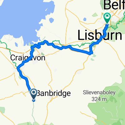
Overview
About this route
day 2 larne-clonakilty
- -:--
- Duration
- 179 km
- Distance
- 639 m
- Ascent
- 600 m
- Descent
- ---
- Avg. speed
- ---
- Max. altitude

Route quality
Waytypes & surfaces along the route
Waytypes
Road
21.5 km
(12 %)
Quiet road
19.7 km
(11 %)
Surfaces
Paved
143.2 km
(80 %)
Asphalt
141.4 km
(79 %)
Paved (undefined)
1.8 km
(1 %)
Undefined
35.8 km
(20 %)
Continue with Bikemap
Use, edit, or download this cycling route
You would like to ride armagh- tullamore or customize it for your own trip? Here is what you can do with this Bikemap route:
Free features
- Save this route as favorite or in collections
- Copy & plan your own version of this route
- Split it into stages to create a multi-day tour
- Sync your route with Garmin or Wahoo
Premium features
Free trial for 3 days, or one-time payment. More about Bikemap Premium.
- Navigate this route on iOS & Android
- Export a GPX / KML file of this route
- Create your custom printout (try it for free)
- Download this route for offline navigation
Discover more Premium features.
Get Bikemap PremiumFrom our community
Other popular routes starting in Tandragee
 Gosford Road, Armagh to Gosford Road, Armagh
- Distance
- 7.8 km
- Ascent
- 68 m
- Descent
- 77 m
- Location
- Tandragee, Northern Ireland, United Kingdom
 18 Old Mill Manor, Craigavon to 18 Old Mill Manor, Craigavon
- Distance
- 16.5 km
- Ascent
- 85 m
- Descent
- 86 m
- Location
- Tandragee, Northern Ireland, United Kingdom
 21 Old Mill Manor, Craigavon to 16 Old Mill Manor, Craigavon
- Distance
- 19 km
- Ascent
- 234 m
- Descent
- 234 m
- Location
- Tandragee, Northern Ireland, United Kingdom
 20 Old Mill Manor, Craigavon to 59–99 High St, Portadown, Craigavon
- Distance
- 8.5 km
- Ascent
- 248 m
- Descent
- 244 m
- Location
- Tandragee, Northern Ireland, United Kingdom
 1A Main St, Craigavon to 1A Main St, Craigavon
- Distance
- 28.5 km
- Ascent
- 9 m
- Descent
- 9 m
- Location
- Tandragee, Northern Ireland, United Kingdom
 3 Beech Park, Craigavon to 3 Beech Park, Craigavon
- Distance
- 55.3 km
- Ascent
- 204 m
- Descent
- 206 m
- Location
- Tandragee, Northern Ireland, United Kingdom
 18 Old Mill Manor, Craigavon to 19 Old Mill Manor, Craigavon
- Distance
- 19.3 km
- Ascent
- 1,646 m
- Descent
- 1,648 m
- Location
- Tandragee, Northern Ireland, United Kingdom
 Gilford Road nach Greenmount
- Distance
- 60.8 km
- Ascent
- 303 m
- Descent
- 347 m
- Location
- Tandragee, Northern Ireland, United Kingdom
Open it in the app