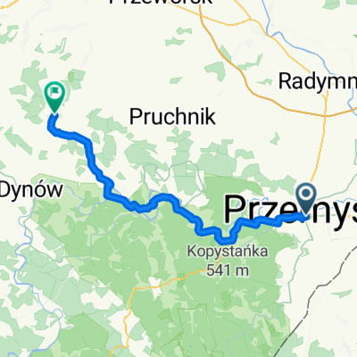
Cyklokarpaty 2009 Przemyśl - Mega
- 34.8 km
- 741 m
- 631 m
- Przemyśl, Subcarpathian Voivodeship, Poland
Loop route from Przemyśl, through Pikulice, Grochowce, Kniażyce, Fredropol, Aksmanice, Koniuszą, Gruszową, Rybotycze, Posadę Rybotycką, Trójcę, the former villages of Jamna Dolna and Jamna Górna, Arłamów, Makową, Huwniki, Górę Hyb, and back again to Fredropol-Przemyśl.
Road
65.1 km79 %Track
7.4 km9 %Paved
69.2 km(84 %)Asphalt
69.2 km84 %Undefined
13.2 km16 %Most Orląt Przemyskich. Początek zielonego szlaku turystycznego.
Twierdza Przemyśl - Fort IV Optyń.
Twierdza Przemyśl - Fort V Grochowce
We wsi stoi murowana cerkiew, zbudowana w latach 1908-1909.
Ruiny zamku Fredrów z XVI/XVIIw. Cerkiew greckokatolicka pw. Soboru Bogarodzicy z 1922r.
Zabytkowa Cerkiew greckokatolicka z 1860r.
Punkt widokowy Szybenica (490m.n.p.m) na Kalwarię Pacławską.
Drewniana cerkiew z 1901r.
Ciekawa Kapliczka i punkt widokowy na Kopystankę (541m.n.p.m).
Punkt widokowy na masyw Suchego Obycza (618m.n.p.m), dolinę Wiaru i wieś Makowa.
Punkt widokowy na Dolinę Wiaru i wieś Makowa.
Wodospad o największym w Województwie Podkarpackim spadku wód - 19m.
Kopystanka 541(m.n.p.m). Przechodzi tędy czerwony szlak turystyczny z Przemyśla do Birczy oraz rozpoczyna się żółty szlak turystyczny na Suchy Obycz 618(m.n.p.m)
Murowana cerkiew obronna Św. Onufrego - najstarsza zachowana cerkiew w Polsce.
Wypalarnia węgla drzewnego.
Łowisko pstrągowe Hotelu Arłamów.
Hotel Arłamów, 2 wyciągi narciarskie z oświetleniem, sztucznym naśnieżaniem, trasy do narciarstwa biegowego.
Punkt widokowy na Połoninki Arłamowskie i dawną wieś Arłamów.
Suchy Obycz (618m.n.p.m). Tu kończy się żółty szlak turystyczny prowadzący z Kopystanki. Niebieski szlak turystyczny prowadzący z Kalwarii Pacławskiej w kierunku Ustrzyk Dolnych.
Niebieski szlak turystyczny na Kalwarię Pacławską.
Punkt widokowy na Dolinę Wiaru, wieś Huwniki i Kalwarię Pacławską.
Drewniana cerkiew Opieki Matki Bożej, zbudowana na miejscu starszej cerkwi w 1856-1860r.
Dawna cerkiew greckokatolicka pw. Zmartwychstania Pańskiego i Niepokalanego Poczęcia Bogarodzicy wzniesiona w 1923r na miejscu dawnej drewnianej cerkwi.
Tu czasem przebywa taki jeden Gościu :)
Free trial for 3 days, or one-time payment. More about Bikemap Premium.
Discover more Premium features.
Get Bikemap PremiumOpen it in the app