

Route to 31.827° N 35.023° W
A cycling route starting in Bayt Liqyā, West Bank, Palestine.
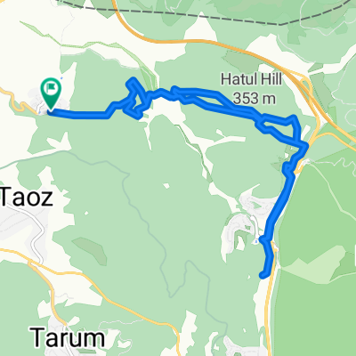
Overview
About this route
- 1 h 50 min
- Duration
- 7.9 km
- Distance
- 236 m
- Ascent
- 231 m
- Descent
- 4.3 km/h
- Avg. speed
- 345 m
- Max. altitude

Continue with Bikemap
Use, edit, or download this cycling route
You would like to ride Route to 31.827° N 35.023° W or customize it for your own trip? Here is what you can do with this Bikemap route:
Free features
- Save this route as favorite or in collections
- Copy & plan your own version of this route
- Sync your route with Garmin or Wahoo
Premium features
Free trial for 3 days, or one-time payment. More about Bikemap Premium.
- Navigate this route on iOS & Android
- Export a GPX / KML file of this route
- Create your custom printout (try it for free)
- Download this route for offline navigation
Discover more Premium features.
Get Bikemap PremiumFrom our community
Other popular routes starting in Bayt Liqyā
 נוה שלום, יער אשתאול
- Distance
- 8.2 km
- Ascent
- 101 m
- Descent
- 96 m
- Location
- Bayt Liqyā, West Bank, Palestine
 Neve Shalom 2
- Distance
- 10.9 km
- Ascent
- 180 m
- Descent
- 188 m
- Location
- Bayt Liqyā, West Bank, Palestine
 נוה שלום,מצ.שער הגיא,סן מרטין
- Distance
- 15.5 km
- Ascent
- 350 m
- Descent
- 351 m
- Location
- Bayt Liqyā, West Bank, Palestine
 פארק קנדה
- Distance
- 9.5 km
- Ascent
- 213 m
- Descent
- 216 m
- Location
- Bayt Liqyā, West Bank, Palestine
 Neve Shalom
- Distance
- 13.6 km
- Ascent
- 76 m
- Descent
- 198 m
- Location
- Bayt Liqyā, West Bank, Palestine
 ןןיייח
- Distance
- 3.5 km
- Ascent
- 44 m
- Descent
- 101 m
- Location
- Bayt Liqyā, West Bank, Palestine
 נוה שלום, בורמה, מסילת ציון
- Distance
- 15.9 km
- Ascent
- 243 m
- Descent
- 243 m
- Location
- Bayt Liqyā, West Bank, Palestine
 friday
- Distance
- 36.5 km
- Ascent
- 767 m
- Descent
- 775 m
- Location
- Bayt Liqyā, West Bank, Palestine
Open it in the app