

Overview
About this route
- 6 h 37 min
- Duration
- 99.3 km
- Distance
- 1,359 m
- Ascent
- 1,653 m
- Descent
- 15 km/h
- Avg. speed
- 507 m
- Max. altitude

Part of
Brüx 2025
11 stages
Route quality
Waytypes & surfaces along the route
Waytypes
Road
61.5 km
(62 %)
Quiet road
9.9 km
(10 %)
Surfaces
Paved
9.9 km
(10 %)
Unpaved
7.9 km
(8 %)
Asphalt
9.9 km
(10 %)
Gravel
7.9 km
(8 %)
Undefined
81.4 km
(82 %)
Route highlights
Points of interest along the route
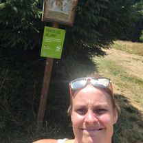
Point of interest after 51.5 km
Mittag
Continue with Bikemap
Use, edit, or download this cycling route
You would like to ride Vater Brüx 05 8.6.2025 or customize it for your own trip? Here is what you can do with this Bikemap route:
Free features
- Save this route as favorite or in collections
- Copy & plan your own version of this route
- Split it into stages to create a multi-day tour
- Sync your route with Garmin or Wahoo
Premium features
Free trial for 3 days, or one-time payment. More about Bikemap Premium.
- Navigate this route on iOS & Android
- Export a GPX / KML file of this route
- Create your custom printout (try it for free)
- Download this route for offline navigation
Discover more Premium features.
Get Bikemap PremiumFrom our community
Other popular routes starting in Příbram
 Brdy - Tok - Jordán
- Distance
- 52 km
- Ascent
- 759 m
- Descent
- 757 m
- Location
- Příbram, Central Bohemia, Czechia
 Za Kofoulou do Smolotel
- Distance
- 39.3 km
- Ascent
- 474 m
- Descent
- 471 m
- Location
- Příbram, Central Bohemia, Czechia
 Příbram_úraz
- Distance
- 35 km
- Ascent
- 447 m
- Descent
- 455 m
- Location
- Příbram, Central Bohemia, Czechia
 Vater Brüx 05 8.6.2025 Auto
- Distance
- 105.7 km
- Ascent
- 1,406 m
- Descent
- 1,700 m
- Location
- Příbram, Central Bohemia, Czechia
 Příbram, Obecnice, Padrťské rybníky, Nepomuk, Příbram
- Distance
- 48 km
- Ascent
- 616 m
- Descent
- 616 m
- Location
- Příbram, Central Bohemia, Czechia
 2018_08_25 Na vrchol
- Distance
- 56.5 km
- Ascent
- 696 m
- Descent
- 802 m
- Location
- Příbram, Central Bohemia, Czechia
 9.4.2011
- Distance
- 49.1 km
- Ascent
- 341 m
- Descent
- 338 m
- Location
- Příbram, Central Bohemia, Czechia
 Brodská - Tok
- Distance
- 29.9 km
- Ascent
- 421 m
- Descent
- 472 m
- Location
- Příbram, Central Bohemia, Czechia
Open it in the app