

Tucson to Tucson
A cycling route starting in Flowing Wells, Arizona, United States.
Overview
About this route
- 2 h 59 min
- Duration
- 44.3 km
- Distance
- 147 m
- Ascent
- 147 m
- Descent
- 14.9 km/h
- Avg. speed
- 769 m
- Max. altitude

Route quality
Waytypes & surfaces along the route
Waytypes
Cycleway
38.3 km
(86 %)
Quiet road
3.1 km
(7 %)
Surfaces
Paved
37.4 km
(84 %)
Asphalt
37 km
(84 %)
Concrete
0.4 km
(<1 %)
Undefined
6.9 km
(16 %)
Continue with Bikemap
Use, edit, or download this cycling route
You would like to ride Tucson to Tucson or customize it for your own trip? Here is what you can do with this Bikemap route:
Free features
- Save this route as favorite or in collections
- Copy & plan your own version of this route
- Sync your route with Garmin or Wahoo
Premium features
Free trial for 3 days, or one-time payment. More about Bikemap Premium.
- Navigate this route on iOS & Android
- Export a GPX / KML file of this route
- Create your custom printout (try it for free)
- Download this route for offline navigation
Discover more Premium features.
Get Bikemap PremiumFrom our community
Other popular routes starting in Flowing Wells
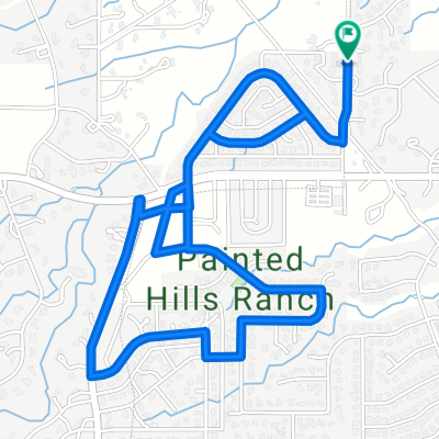
 Painted Hills Loop
- Distance
- 13.7 km
- Ascent
- 129 m
- Descent
- 109 m
- Location
- Flowing Wells, Arizona, United States
 Rillito Bike Path
- Distance
- 14.2 km
- Ascent
- 30 m
- Descent
- 27 m
- Location
- Flowing Wells, Arizona, United States
 10/9/17
- Distance
- 5.3 km
- Ascent
- 40 m
- Descent
- 39 m
- Location
- Flowing Wells, Arizona, United States
 The Loop - Tucson
- Distance
- 86.3 km
- Ascent
- 1,054 m
- Descent
- 1,075 m
- Location
- Flowing Wells, Arizona, United States
 4/25 The loop Sweetwater/Rillito
- Distance
- 31.5 km
- Ascent
- 58 m
- Descent
- 58 m
- Location
- Flowing Wells, Arizona, United States
 Gates Pass and McCain Loop
- Distance
- 38.4 km
- Ascent
- 541 m
- Descent
- 525 m
- Location
- Flowing Wells, Arizona, United States
 Sweetwater Wetlands trip
- Distance
- 25.8 km
- Ascent
- 52 m
- Descent
- 53 m
- Location
- Flowing Wells, Arizona, United States
 kokokok
- Distance
- 1.7 km
- Ascent
- 45 m
- Descent
- 49 m
- Location
- Flowing Wells, Arizona, United States
Open it in the app