

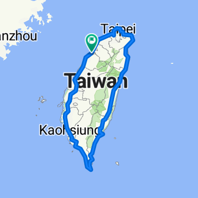
TW_Hsinchu - Yuanlin City
A cycling route starting in Hsinchu, Taiwan, Taiwan.
Overview
About this route
- 7 h 46 min
- Duration
- 125.5 km
- Distance
- 417 m
- Ascent
- 407 m
- Descent
- 16.2 km/h
- Avg. speed
- 65 m
- Max. altitude
Route quality
Waytypes & surfaces along the route
Waytypes
Road
26.4 km
(21 %)
Cycleway
10 km
(8 %)
Surfaces
Paved
54 km
(43 %)
Asphalt
54 km
(43 %)
Undefined
71.5 km
(57 %)
Continue with Bikemap
Use, edit, or download this cycling route
You would like to ride TW_Hsinchu - Yuanlin City or customize it for your own trip? Here is what you can do with this Bikemap route:
Free features
- Save this route as favorite or in collections
- Copy & plan your own version of this route
- Split it into stages to create a multi-day tour
- Sync your route with Garmin or Wahoo
Premium features
Free trial for 3 days, or one-time payment. More about Bikemap Premium.
- Navigate this route on iOS & Android
- Export a GPX / KML file of this route
- Create your custom printout (try it for free)
- Download this route for offline navigation
Discover more Premium features.
Get Bikemap PremiumFrom our community
Other popular routes starting in Hsinchu
 新竹魔神300K
- Distance
- 332.1 km
- Ascent
- 4,146 m
- Descent
- 4,146 m
- Location
- Hsinchu, Taiwan, Taiwan
 寶山水庫+寶二水庫
- Distance
- 38.1 km
- Ascent
- 581 m
- Descent
- 576 m
- Location
- Hsinchu, Taiwan, Taiwan
 教育大學_新城_水流東_永和山水庫_台一線
- Distance
- 51.3 km
- Ascent
- 492 m
- Descent
- 492 m
- Location
- Hsinchu, Taiwan, Taiwan
 環島I
環島I- Distance
- 1,115.9 km
- Ascent
- 1,758 m
- Descent
- 1,758 m
- Location
- Hsinchu, Taiwan, Taiwan
 20200822父子倆騎行17公里中段
- Distance
- 5.5 km
- Ascent
- 0 m
- Descent
- 3 m
- Location
- Hsinchu, Taiwan, Taiwan
 新竹-羅馬公路-大溪
- Distance
- 118.5 km
- Ascent
- 2,929 m
- Descent
- 2,854 m
- Location
- Hsinchu, Taiwan, Taiwan
 20070430_峨嵋湖
- Distance
- 11.6 km
- Ascent
- 203 m
- Descent
- 186 m
- Location
- Hsinchu, Taiwan, Taiwan
 新竹17公里海岸
- Distance
- 37 km
- Ascent
- 51 m
- Descent
- 49 m
- Location
- Hsinchu, Taiwan, Taiwan
Open it in the app