

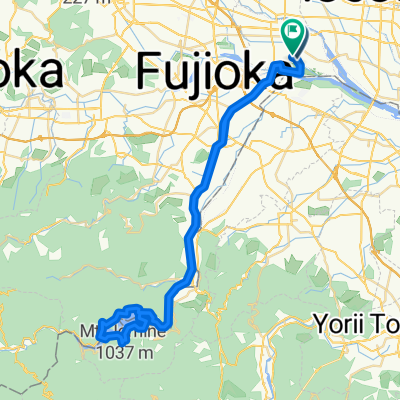
新町2103-26, 高崎市へ児玉町共栄360-1, 本庄市
A cycling route starting in Tamamura, Gunma, Japan.
Overview
About this route
- 45 min
- Duration
- 11.5 km
- Distance
- 34 m
- Ascent
- 20 m
- Descent
- 15.3 km/h
- Avg. speed
- 94 m
- Max. altitude

Route quality
Waytypes & surfaces along the route
Waytypes
Cycleway
4 km
(35 %)
Road
2.8 km
(24 %)
Surfaces
Paved
2.8 km
(24 %)
Paved (undefined)
2 km
(17 %)
Asphalt
0.8 km
(7 %)
Undefined
8.8 km
(76 %)
Continue with Bikemap
Use, edit, or download this cycling route
You would like to ride 新町2103-26, 高崎市へ児玉町共栄360-1, 本庄市 or customize it for your own trip? Here is what you can do with this Bikemap route:
Free features
- Save this route as favorite or in collections
- Copy & plan your own version of this route
- Sync your route with Garmin or Wahoo
Premium features
Free trial for 3 days, or one-time payment. More about Bikemap Premium.
- Navigate this route on iOS & Android
- Export a GPX / KML file of this route
- Create your custom printout (try it for free)
- Download this route for offline navigation
Discover more Premium features.
Get Bikemap PremiumFrom our community
Other popular routes starting in Tamamura
 広瀬川サイクリングロード
- Distance
- 6.1 km
- Ascent
- 18 m
- Descent
- 26 m
- Location
- Tamamura, Gunma, Japan
 上里歴史巡りルート (上里町ルート)
- Distance
- 14.3 km
- Ascent
- 32 m
- Descent
- 30 m
- Location
- Tamamura, Gunma, Japan
 国道354号, Takasaki a 1879-4, Amborimachi, Isesaki
- Distance
- 15.8 km
- Ascent
- 35 m
- Descent
- 38 m
- Location
- Tamamura, Gunma, Japan
 350, Kamiiijima, Tamamura, Sawa-Gun to 351-2, Kamiiijima, Tamamura, Sawa-Gun
- Distance
- 38.7 km
- Ascent
- 355 m
- Descent
- 358 m
- Location
- Tamamura, Gunma, Japan
 1189-4, Shimoshinden, Tamamura, Sawa-Gun to Azumachogodo, Midori
- Distance
- 48.6 km
- Ascent
- 1,085 m
- Descent
- 737 m
- Location
- Tamamura, Gunma, Japan
 新町2103-26, 高崎市へ児玉町共栄360-1, 本庄市
- Distance
- 11.5 km
- Ascent
- 34 m
- Descent
- 20 m
- Location
- Tamamura, Gunma, Japan
 Shimomogi, Tamamura to Shimomogi, Tamamura
- Distance
- 65 km
- Ascent
- 774 m
- Descent
- 773 m
- Location
- Tamamura, Gunma, Japan
 900-2, Kamitakimachi, Takasaki-Shi to 900-2, Kamitakimachi, Takasaki-Shi
- Distance
- 64.7 km
- Ascent
- 201 m
- Descent
- 205 m
- Location
- Tamamura, Gunma, Japan
Open it in the app