
la luzette
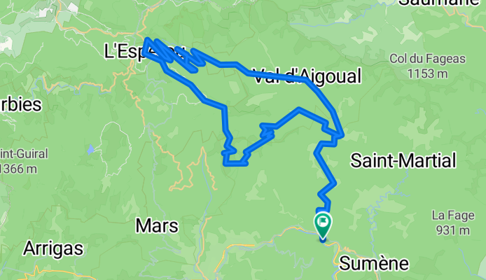
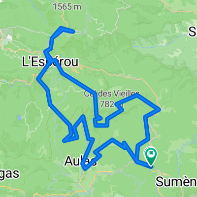
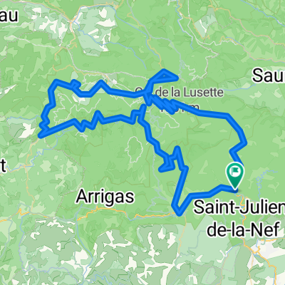
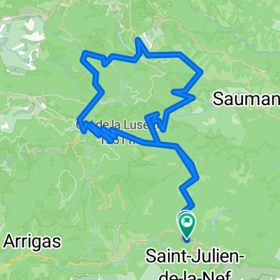
A cycling route starting in Sumène, Occitanie, France.
Overview
About this route
- -:--
- Duration
- 69.6 km
- Distance
- 1,310 m
- Ascent
- 1,310 m
- Descent
- ---
- Avg. speed
- ---
- Max. altitude
Route quality
Waytypes & surfaces along the route
Waytypes
Road
25.1 km
(36 %)
Quiet road
0.7 km
(1 %)
Undefined
43.9 km
(63 %)
Surfaces
Paved
49.4 km
(71 %)
Asphalt
49.4 km
(71 %)
Undefined
20.2 km
(29 %)
Route highlights
Points of interest along the route
Point of interest after 69.5 km
Parking départ
Continue with Bikemap
Use, edit, or download this cycling route
You would like to ride la luzette or customize it for your own trip? Here is what you can do with this Bikemap route:
Free features
- Save this route as favorite or in collections
- Copy & plan your own version of this route
- Sync your route with Garmin or Wahoo
Premium features
Free trial for 3 days, or one-time payment. More about Bikemap Premium.
- Navigate this route on iOS & Android
- Export a GPX / KML file of this route
- Create your custom printout (try it for free)
- Download this route for offline navigation
Discover more Premium features.
Get Bikemap PremiumFrom our community
Other popular routes starting in Sumène
 Mont Aigoual
- Distance
- 61.7 km
- Ascent
- 1,349 m
- Descent
- 1,361 m
- Location
- Sumène, Occitanie, France
 Mont aigoual VF
- Distance
- 89.9 km
- Ascent
- 1,874 m
- Descent
- 1,877 m
- Location
- Sumène, Occitanie, France
 Mont Aigoual 2015 ModiPoli
- Distance
- 98.6 km
- Ascent
- 1,585 m
- Descent
- 1,587 m
- Location
- Sumène, Occitanie, France
 Portée Est Aigoual
- Distance
- 91.5 km
- Ascent
- 1,399 m
- Descent
- 1,399 m
- Location
- Sumène, Occitanie, France
 autour de l aigoual
- Distance
- 130.2 km
- Ascent
- 2,042 m
- Descent
- 2,044 m
- Location
- Sumène, Occitanie, France
 8b.Etappe FR2018
- Distance
- 112.2 km
- Ascent
- 1,474 m
- Descent
- 1,658 m
- Location
- Sumène, Occitanie, France
 TDG 5 PEYREGROSSE LE VIGAN
- Distance
- 133.5 km
- Ascent
- 1,961 m
- Descent
- 1,959 m
- Location
- Sumène, Occitanie, France
 Aigoual - Col du Pas
- Distance
- 108.2 km
- Ascent
- 1,821 m
- Descent
- 1,796 m
- Location
- Sumène, Occitanie, France
Open it in the app