

30km RundeOerlenbach_Sulzthal
A cycling route starting in Oerlenbach, Bavaria, Germany.
Overview
About this route
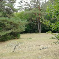
Varied route often near the forest. No technical demands.
The hill near Sulzthal is the only challenge for the inexperienced cyclist.
- -:--
- Duration
- 30.8 km
- Distance
- 404 m
- Ascent
- 405 m
- Descent
- ---
- Avg. speed
- ---
- Max. altitude
Route quality
Waytypes & surfaces along the route
Waytypes
Track
12.6 km
(41 %)
Quiet road
8 km
(26 %)
Surfaces
Paved
18.8 km
(61 %)
Unpaved
6.8 km
(22 %)
Asphalt
14.5 km
(47 %)
Gravel
5.2 km
(17 %)
Continue with Bikemap
Use, edit, or download this cycling route
You would like to ride 30km RundeOerlenbach_Sulzthal or customize it for your own trip? Here is what you can do with this Bikemap route:
Free features
- Save this route as favorite or in collections
- Copy & plan your own version of this route
- Sync your route with Garmin or Wahoo
Premium features
Free trial for 3 days, or one-time payment. More about Bikemap Premium.
- Navigate this route on iOS & Android
- Export a GPX / KML file of this route
- Create your custom printout (try it for free)
- Download this route for offline navigation
Discover more Premium features.
Get Bikemap PremiumFrom our community
Other popular routes starting in Oerlenbach
 mtbdriver Hausstrecke
- Distance
- 28.1 km
- Ascent
- 254 m
- Descent
- 254 m
- Location
- Oerlenbach, Bavaria, Germany
 Oerlenbacher Straße 11 nach Im Gereuth 10, Oerlenbach
- Distance
- 38.2 km
- Ascent
- 393 m
- Descent
- 397 m
- Location
- Oerlenbach, Bavaria, Germany
 Bischofsheim - Würzburg
- Distance
- 268.6 km
- Ascent
- 1,174 m
- Descent
- 1,169 m
- Location
- Oerlenbach, Bavaria, Germany
 Hennebergstraße 31-33, Oerlenbach nach Hennebergstraße 33, Oerlenbach
- Distance
- 19.2 km
- Ascent
- 165 m
- Descent
- 206 m
- Location
- Oerlenbach, Bavaria, Germany
 Bayernstraße 49A, Oerlenbach nach Bayernstraße 49A, Oerlenbach
- Distance
- 14.4 km
- Ascent
- 99 m
- Descent
- 94 m
- Location
- Oerlenbach, Bavaria, Germany
 Hennebergstraße 33, Oerlenbach nach Reichenbacher Straße, Münnerstadt
- Distance
- 24.2 km
- Ascent
- 174 m
- Descent
- 275 m
- Location
- Oerlenbach, Bavaria, Germany
 Hennebergstraße 33, Oerlenbach nach Hennebergstraße 33, Oerlenbach
- Distance
- 17.7 km
- Ascent
- 137 m
- Descent
- 185 m
- Location
- Oerlenbach, Bavaria, Germany
 Kleine Werntalrunde
- Distance
- 24.2 km
- Ascent
- 263 m
- Descent
- 268 m
- Location
- Oerlenbach, Bavaria, Germany
Open it in the app