
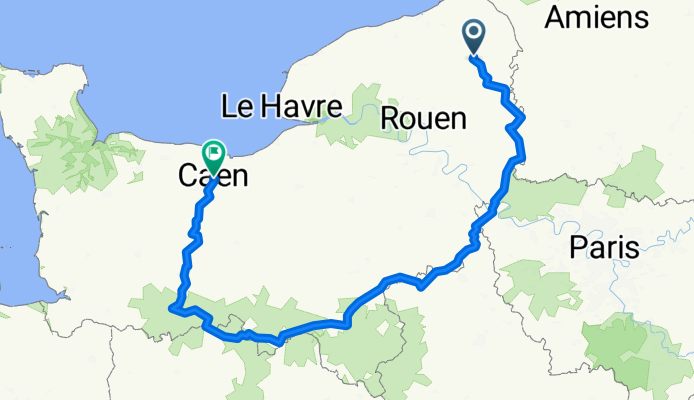
Normandy Cycling 2025
A cycling route starting in Neufchâtel-en-Bray, Normandy, France.
Overview
About this route
- 26 h 54 min
- Duration
- 443.1 km
- Distance
- 3,311 m
- Ascent
- 3,397 m
- Descent
- 16.5 km/h
- Avg. speed
- 319 m
- Max. altitude

Route quality
Waytypes & surfaces along the route
Waytypes
Path
199.4 km
(45 %)
Quiet road
124.1 km
(28 %)
Surfaces
Paved
186.1 km
(42 %)
Unpaved
93 km
(21 %)
Asphalt
186.1 km
(42 %)
Gravel
93 km
(21 %)
Undefined
163.9 km
(37 %)
Continue with Bikemap
Use, edit, or download this cycling route
You would like to ride Normandy Cycling 2025 or customize it for your own trip? Here is what you can do with this Bikemap route:
Free features
- Save this route as favorite or in collections
- Copy & plan your own version of this route
- Split it into stages to create a multi-day tour
- Sync your route with Garmin or Wahoo
Premium features
Free trial for 3 days, or one-time payment. More about Bikemap Premium.
- Navigate this route on iOS & Android
- Export a GPX / KML file of this route
- Create your custom printout (try it for free)
- Download this route for offline navigation
Discover more Premium features.
Get Bikemap PremiumFrom our community
Other popular routes starting in Neufchâtel-en-Bray
 London to Paris part 1 of day 5
- Distance
- 19 km
- Ascent
- 214 m
- Descent
- 135 m
- Location
- Neufchâtel-en-Bray, Normandy, France
 Neufchâtel-en-Bray to 2 Chemin de Trefforest, Mesnil-Mauger
- Distance
- 12.2 km
- Ascent
- 82 m
- Descent
- 16 m
- Location
- Neufchâtel-en-Bray, Normandy, France
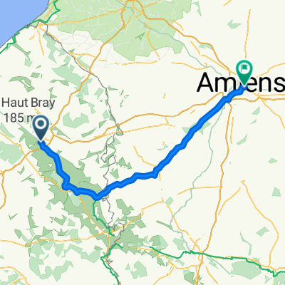 Neufchâtel-en-Bray to Amiens
- Distance
- 95.9 km
- Ascent
- 722 m
- Descent
- 761 m
- Location
- Neufchâtel-en-Bray, Normandy, France
 De Impasse de la Gare 29, Neufchâtel-en-Bray à Rue de la Gare 25, Neufchâtel-en-Bray
- Distance
- 73.9 km
- Ascent
- 579 m
- Descent
- 576 m
- Location
- Neufchâtel-en-Bray, Normandy, France
 19 Rue Sainte-Claire, Neufchâtel-en-Bray to Passage Jacques Eliot, Beaubec-la-Rosière
- Distance
- 13.6 km
- Ascent
- 81 m
- Descent
- 6 m
- Location
- Neufchâtel-en-Bray, Normandy, France
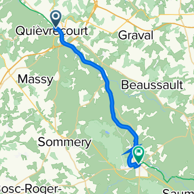
 Rue du Baron d'Haussez, Neufchâtel-en-Bray to Rue des Argilières, Gisors
- Distance
- 79.6 km
- Ascent
- 581 m
- Descent
- 620 m
- Location
- Neufchâtel-en-Bray, Normandy, France
 Neufchâtel-en-Bray to 2–4 Place de la République, Forges-les-Eaux
- Distance
- 19.7 km
- Ascent
- 154 m
- Descent
- 69 m
- Location
- Neufchâtel-en-Bray, Normandy, France
 day 2 - Le Mont Florentin
- Distance
- 76 km
- Ascent
- 625 m
- Descent
- 490 m
- Location
- Neufchâtel-en-Bray, Normandy, France
Open it in the app