

Perche 27/ 04 /25 départ de Frazé
A cycling route starting in Brou, Centre-Val de Loire, France.
Overview
About this route
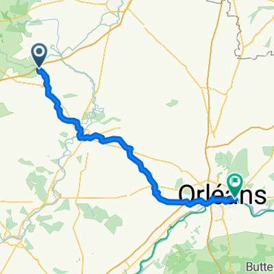
Frazé - la Croix du Perche - Vichère - Trizay Coutretot - Beauvais - Mâle - Fée - Chevilly - Ceton - Saint Boner - Authon du Perche - Les Charmes - Luigny - Le Souchet - Les Tonnes - Unverre - Dampierre sous Brou - La Muloterie - les Sablonnières - les Oiselleries - turn right at Brou towards Frazé
- 6 h 24 min
- Duration
- 98.4 km
- Distance
- 1,003 m
- Ascent
- 1,002 m
- Descent
- 15.4 km/h
- Avg. speed
- 283 m
- Max. altitude

Route photos

Route quality
Waytypes & surfaces along the route
Waytypes
Road
52.2 km
(53 %)
Quiet road
18.7 km
(19 %)
Surfaces
Paved
9.8 km
(10 %)
Asphalt
9.8 km
(10 %)
Undefined
88.6 km
(90 %)
Route highlights
Points of interest along the route
Point of interest after 0 km
point de RDV restaurant Le Pré de Frazé
Continue with Bikemap
Use, edit, or download this cycling route
You would like to ride Perche 27/ 04 /25 départ de Frazé or customize it for your own trip? Here is what you can do with this Bikemap route:
Free features
- Save this route as favorite or in collections
- Copy & plan your own version of this route
- Split it into stages to create a multi-day tour
- Sync your route with Garmin or Wahoo
Premium features
Free trial for 3 days, or one-time payment. More about Bikemap Premium.
- Navigate this route on iOS & Android
- Export a GPX / KML file of this route
- Create your custom printout (try it for free)
- Download this route for offline navigation
Discover more Premium features.
Get Bikemap PremiumFrom our community
Other popular routes starting in Brou
 Relaxed route in Frazé
- Distance
- 12.5 km
- Ascent
- 113 m
- Descent
- 65 m
- Location
- Brou, Centre-Val de Loire, France
 De Rue du Foyer 1, Brou à Rue du Foyer 1, Brou
- Distance
- 28.9 km
- Ascent
- 239 m
- Descent
- 239 m
- Location
- Brou, Centre-Val de Loire, France
 WCC Tour Day 3: Brou-Paris
- Distance
- 155 km
- Ascent
- 437 m
- Descent
- 552 m
- Location
- Brou, Centre-Val de Loire, France
 Brou - Saint-Jean-de-Braye
- Distance
- 100.9 km
- Ascent
- 201 m
- Descent
- 285 m
- Location
- Brou, Centre-Val de Loire, France
- Perche 27/ 04 /25 départ de Frazé
- Distance
- 98.4 km
- Ascent
- 1,003 m
- Descent
- 1,002 m
- Location
- Brou, Centre-Val de Loire, France
 2004 ツール観戦記 第6ステージ 走行ルート
- Distance
- 214.4 km
- Ascent
- 511 m
- Descent
- 639 m
- Location
- Brou, Centre-Val de Loire, France
 De L'Océane, Vieuvicq à 28 Rue de la Herse, Nogent-le-Rotrou
- Distance
- 42.5 km
- Ascent
- 356 m
- Descent
- 407 m
- Location
- Brou, Centre-Val de Loire, France
 france 2009-10 brou-tours
- Distance
- 115.3 km
- Ascent
- 280 m
- Descent
- 382 m
- Location
- Brou, Centre-Val de Loire, France
Open it in the app