

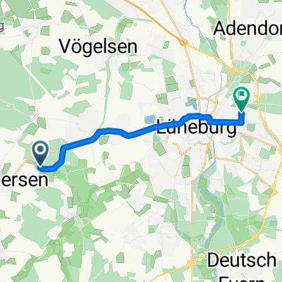
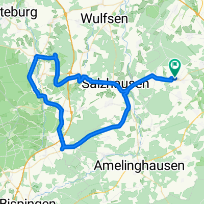
Kirchgellersen-Radbruch-Luhdorf-Thieshope-Jesteburg-Holm-Buchholz-zurück
A cycling route starting in Kirchgellersen, Lower Saxony, Germany.
Overview
About this route
<div class='trackDescription'>
<p>Recorded with a Garmin Edge 800;</p>
<p></p>
<p>When you come to Schierhorn for the first time, turn right. The second time, turn left again towards Lüneburg.</p>
</div>
Translated, show original (German)- -:--
- Duration
- 91.5 km
- Distance
- 303 m
- Ascent
- 301 m
- Descent
- ---
- Avg. speed
- ---
- Max. altitude

Route quality
Waytypes & surfaces along the route
Waytypes
Path
24.7 km
(27 %)
Road
12.8 km
(14 %)
Surfaces
Paved
70.5 km
(77 %)
Unpaved
0.9 km
(1 %)
Asphalt
58.6 km
(64 %)
Concrete
11 km
(12 %)
Continue with Bikemap
Use, edit, or download this cycling route
You would like to ride Kirchgellersen-Radbruch-Luhdorf-Thieshope-Jesteburg-Holm-Buchholz-zurück or customize it for your own trip? Here is what you can do with this Bikemap route:
Free features
- Save this route as favorite or in collections
- Copy & plan your own version of this route
- Split it into stages to create a multi-day tour
- Sync your route with Garmin or Wahoo
Premium features
Free trial for 3 days, or one-time payment. More about Bikemap Premium.
- Navigate this route on iOS & Android
- Export a GPX / KML file of this route
- Create your custom printout (try it for free)
- Download this route for offline navigation
Discover more Premium features.
Get Bikemap PremiumFrom our community
Other popular routes starting in Kirchgellersen
 Meyja Wald
- Distance
- 9.2 km
- Ascent
- 36 m
- Descent
- 32 m
- Location
- Kirchgellersen, Lower Saxony, Germany
 Rundfahrt Lüneburg, Lauenburg, Boizenburg, Bleckede
- Distance
- 97.7 km
- Ascent
- 251 m
- Descent
- 250 m
- Location
- Kirchgellersen, Lower Saxony, Germany
 Landwehr-Singletrail_Lüneburg
- Distance
- 54.8 km
- Ascent
- 227 m
- Descent
- 231 m
- Location
- Kirchgellersen, Lower Saxony, Germany
 Heiligenthal Waldfahrt
- Distance
- 29.8 km
- Ascent
- 155 m
- Descent
- 155 m
- Location
- Kirchgellersen, Lower Saxony, Germany
 Kirchgellersen-Radbruch-Luhdorf-Thieshope-Jesteburg-Holm-Buchholz-zurück
- Distance
- 91.5 km
- Ascent
- 303 m
- Descent
- 301 m
- Location
- Kirchgellersen, Lower Saxony, Germany
 AmRand der Heide
- Distance
- 62.9 km
- Ascent
- 386 m
- Descent
- 433 m
- Location
- Kirchgellersen, Lower Saxony, Germany
 Am Steinbint 21, Kirchgellersen nach Am Steinbint 23, Kirchgellersen
- Distance
- 29.7 km
- Ascent
- 108 m
- Descent
- 109 m
- Location
- Kirchgellersen, Lower Saxony, Germany
 Hohe Linde
- Distance
- 13.3 km
- Ascent
- 53 m
- Descent
- 52 m
- Location
- Kirchgellersen, Lower Saxony, Germany
Open it in the app