

傳說中的136
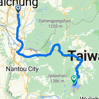
A cycling route starting in Taichung, Taiwan, Taiwan.
Overview
About this route
- -:--
- Duration
- 19.2 km
- Distance
- 997 m
- Ascent
- 961 m
- Descent
- ---
- Avg. speed
- 749 m
- Max. altitude

Route quality
Waytypes & surfaces along the route
Waytypes
Access road
0.2 km
(1 %)
Undefined
19 km
(99 %)
Continue with Bikemap
Use, edit, or download this cycling route
You would like to ride 傳說中的136 or customize it for your own trip? Here is what you can do with this Bikemap route:
Free features
- Save this route as favorite or in collections
- Copy & plan your own version of this route
- Sync your route with Garmin or Wahoo
Premium features
Free trial for 3 days, or one-time payment. More about Bikemap Premium.
- Navigate this route on iOS & Android
- Export a GPX / KML file of this route
- Create your custom printout (try it for free)
- Download this route for offline navigation
Discover more Premium features.
Get Bikemap PremiumFrom our community
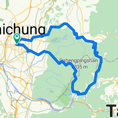
Other popular routes starting in Taichung
 市政公園-向上特三-中沙-大肚-藍色公路-市政公園
- Distance
- 36.3 km
- Ascent
- 463 m
- Descent
- 464 m
- Location
- Taichung, Taiwan, Taiwan
 台中-日月潭
- Distance
- 72.4 km
- Ascent
- 1,089 m
- Descent
- 559 m
- Location
- Taichung, Taiwan, Taiwan
 台中縣136
- Distance
- 32.3 km
- Ascent
- 1,172 m
- Descent
- 997 m
- Location
- Taichung, Taiwan, Taiwan
 台中-日月潭
- Distance
- 157.8 km
- Ascent
- 1,048 m
- Descent
- 1,048 m
- Location
- Taichung, Taiwan, Taiwan
 旱溪自行車道全線
- Distance
- 22.5 km
- Ascent
- 121 m
- Descent
- 80 m
- Location
- Taichung, Taiwan, Taiwan
 大神光_後壁
- Distance
- 10.3 km
- Ascent
- 386 m
- Descent
- 389 m
- Location
- Taichung, Taiwan, Taiwan
 德利路_十四窯坪_大石壁_牛角坑_德利路
- Distance
- 10.3 km
- Ascent
- 480 m
- Descent
- 483 m
- Location
- Taichung, Taiwan, Taiwan
 天冷+136
- Distance
- 99.7 km
- Ascent
- 1,364 m
- Descent
- 1,366 m
- Location
- Taichung, Taiwan, Taiwan
Open it in the app