
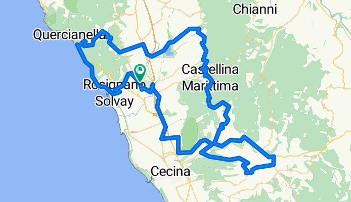
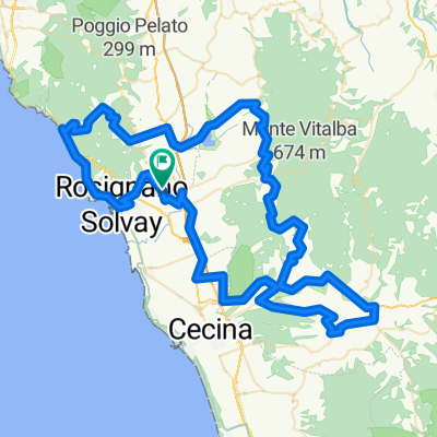
GB. GF del Castello
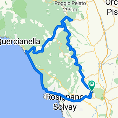
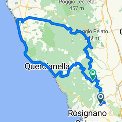
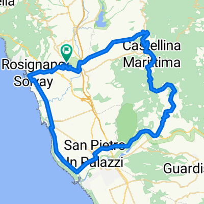
A cycling route starting in Rosignano Marittimo, Tuscany, Italy.
Overview
About this route
<p>Ascent: 1350 m</p>
<p>Climbs</p>
<p>Nibbiaia 5.2 km 4.8%/12%</p>
<p>Santa Luce 6.5 km 2.5%/6.5%</p>
<p>Castellina Mma 3.6 km 5.2%/9%</p>
<p>Guardistallo 3.6 km 9.6%/14%</p>
<p>An average of 32 results in a finish time of 3:19 place: 374/475</p>
<p>An average of 30 results in a finish time of 3:32 place: 391/475</p>
<p>An average of 28 results in a finish time of 3:47 place: 418/475</p>
Translated, show original (Italian)- -:--
- Duration
- 105.9 km
- Distance
- 1,131 m
- Ascent
- 1,131 m
- Descent
- ---
- Avg. speed
- ---
- Max. altitude
Route quality
Waytypes & surfaces along the route
Waytypes
Road
9.5 km
(9 %)
Quiet road
5.3 km
(5 %)
Surfaces
Paved
81.5 km
(77 %)
Asphalt
81.5 km
(77 %)
Undefined
24.4 km
(23 %)
Route highlights
Points of interest along the route
Point of interest after 36.9 km
Vätskekontroll
Continue with Bikemap
Use, edit, or download this cycling route
You would like to ride GB. GF del Castello or customize it for your own trip? Here is what you can do with this Bikemap route:
Free features
- Save this route as favorite or in collections
- Copy & plan your own version of this route
- Split it into stages to create a multi-day tour
- Sync your route with Garmin or Wahoo
Premium features
Free trial for 3 days, or one-time payment. More about Bikemap Premium.
- Navigate this route on iOS & Android
- Export a GPX / KML file of this route
- Create your custom printout (try it for free)
- Download this route for offline navigation
Discover more Premium features.
Get Bikemap PremiumFrom our community
Other popular routes starting in Rosignano Marittimo
 GB. GF del Castello
- Distance
- 105.9 km
- Ascent
- 1,131 m
- Descent
- 1,131 m
- Location
- Rosignano Marittimo, Tuscany, Italy
 Via Sant'Antonio, Rosignano Marittimo a Via Antonio Gramsci, Rosignano Marittimo
- Distance
- 25.3 km
- Ascent
- 305 m
- Descent
- 272 m
- Location
- Rosignano Marittimo, Tuscany, Italy
 Rosignano - Cecina - Riparbella - Castellina - Rosignano
- Distance
- 55.7 km
- Ascent
- 514 m
- Descent
- 514 m
- Location
- Rosignano Marittimo, Tuscany, Italy
 Da Via Roma 156, Castellina Marittima a Via Roma 41, Valdiperga
- Distance
- 28.9 km
- Ascent
- 593 m
- Descent
- 591 m
- Location
- Rosignano Marittimo, Tuscany, Italy
 Oasi santa Luce
- Distance
- 5.2 km
- Ascent
- 68 m
- Descent
- 70 m
- Location
- Rosignano Marittimo, Tuscany, Italy
 Rosignano - Nibbiaia - Gabbro - Rosignano
- Distance
- 37.3 km
- Ascent
- 410 m
- Descent
- 410 m
- Location
- Rosignano Marittimo, Tuscany, Italy
 livorno
- Distance
- 48.6 km
- Ascent
- 830 m
- Descent
- 790 m
- Location
- Rosignano Marittimo, Tuscany, Italy
 Rosignano - Cecina - Riparbella - Castellina - Rosignano CLONED FROM ROUTE 259701
- Distance
- 55.7 km
- Ascent
- 516 m
- Descent
- 516 m
- Location
- Rosignano Marittimo, Tuscany, Italy
Open it in the app