
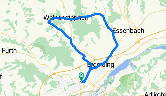
LA-Mirskofen-Oberglaim-LA
A cycling route starting in Ergolding, Bavaria, Germany.
Overview
About this route
Partly flat, partly hilly, partly paved, partly dirt roads
- -:--
- Duration
- 28.9 km
- Distance
- 201 m
- Ascent
- 201 m
- Descent
- ---
- Avg. speed
- ---
- Max. altitude
Route quality
Waytypes & surfaces along the route
Waytypes
Road
10.4 km
(36 %)
Quiet road
6.9 km
(24 %)
Surfaces
Paved
21.1 km
(73 %)
Unpaved
4.6 km
(16 %)
Asphalt
21.1 km
(73 %)
Gravel
3.5 km
(12 %)
Continue with Bikemap
Use, edit, or download this cycling route
You would like to ride LA-Mirskofen-Oberglaim-LA or customize it for your own trip? Here is what you can do with this Bikemap route:
Free features
- Save this route as favorite or in collections
- Copy & plan your own version of this route
- Sync your route with Garmin or Wahoo
Premium features
Free trial for 3 days, or one-time payment. More about Bikemap Premium.
- Navigate this route on iOS & Android
- Export a GPX / KML file of this route
- Create your custom printout (try it for free)
- Download this route for offline navigation
Discover more Premium features.
Get Bikemap PremiumFrom our community
Other popular routes starting in Ergolding
 Klosterholz - Pfettrach - Training
- Distance
- 30.5 km
- Ascent
- 476 m
- Descent
- 476 m
- Location
- Ergolding, Bavaria, Germany
 Pfingstsonntagswarmfahren
- Distance
- 14.9 km
- Ascent
- 213 m
- Descent
- 144 m
- Location
- Ergolding, Bavaria, Germany
 Mittlere Samstagsrunde
- Distance
- 41.6 km
- Ascent
- 252 m
- Descent
- 252 m
- Location
- Ergolding, Bavaria, Germany
 Feierabendrunde
- Distance
- 24.8 km
- Ascent
- 165 m
- Descent
- 168 m
- Location
- Ergolding, Bavaria, Germany
 Ergolding-Rottenburg an der Laaber
- Distance
- 60.8 km
- Ascent
- 514 m
- Descent
- 516 m
- Location
- Ergolding, Bavaria, Germany
 SZ-5a_Ergolding_Mainburg_69,0km 430hm
- Distance
- 66.2 km
- Ascent
- 553 m
- Descent
- 517 m
- Location
- Ergolding, Bavaria, Germany
 Landshuter Waldtour
- Distance
- 52.8 km
- Ascent
- 629 m
- Descent
- 629 m
- Location
- Ergolding, Bavaria, Germany
 Landshut Hohenthann Runde
- Distance
- 41.7 km
- Ascent
- 182 m
- Descent
- 181 m
- Location
- Ergolding, Bavaria, Germany
Open it in the app