

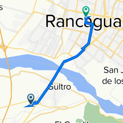
Circunvalacion 1780, Rancagua a Circunvalacion 1780, Rancagua
A cycling route starting in Rancagua, Región del Libertador General Bernardo O’Higgins, Chile.
Overview
About this route
- 1 h 50 min
- Duration
- 29.6 km
- Distance
- 195 m
- Ascent
- 194 m
- Descent
- 16.1 km/h
- Avg. speed
- 652 m
- Avg. speed
Route quality
Waytypes & surfaces along the route
Waytypes
Quiet road
15.1 km
(51 %)
Cycleway
8.7 km
(29 %)
Surfaces
Paved
16.1 km
(54 %)
Unpaved
11.7 km
(39 %)
Asphalt
10.5 km
(35 %)
Ground
8.5 km
(29 %)
Continue with Bikemap
Use, edit, or download this cycling route
You would like to ride Circunvalacion 1780, Rancagua a Circunvalacion 1780, Rancagua or customize it for your own trip? Here is what you can do with this Bikemap route:
Free features
- Save this route as favorite or in collections
- Copy & plan your own version of this route
- Sync your route with Garmin or Wahoo
Premium features
Free trial for 3 days, or one-time payment. More about Bikemap Premium.
- Navigate this route on iOS & Android
- Export a GPX / KML file of this route
- Create your custom printout (try it for free)
- Download this route for offline navigation
Discover more Premium features.
Get Bikemap PremiumFrom our community
Other popular routes starting in Rancagua
 Rancagua
- Distance
- 12.6 km
- Ascent
- 80 m
- Descent
- 81 m
- Location
- Rancagua, Región del Libertador General Bernardo O’Higgins, Chile
 De Camino a El Trigal, Requinoa a Camino a El Trigal, Requinoa
- Distance
- 58.5 km
- Ascent
- 853 m
- Descent
- 860 m
- Location
- Rancagua, Región del Libertador General Bernardo O’Higgins, Chile
 Circunvalacion 1780, Rancagua a Circunvalacion 1780, Rancagua
- Distance
- 29.6 km
- Ascent
- 195 m
- Descent
- 194 m
- Location
- Rancagua, Región del Libertador General Bernardo O’Higgins, Chile
 De Longitudinal Antiguo, Olivar a Alcázar 171, Rancagua
- Distance
- 7.2 km
- Ascent
- 8 m
- Descent
- 26 m
- Location
- Rancagua, Región del Libertador General Bernardo O’Higgins, Chile
 Rancagua - Quebrada los Puquios
- Distance
- 70.3 km
- Ascent
- 1,961 m
- Descent
- 304 m
- Location
- Rancagua, Región del Libertador General Bernardo O’Higgins, Chile
 Rancagua - La Rubiana - Chancon - Campo De Minas - Rancagua
- Distance
- 97 km
- Ascent
- 373 m
- Descent
- 423 m
- Location
- Rancagua, Región del Libertador General Bernardo O’Higgins, Chile
 De San Rafael Arcangel 1441, Rancagua a 2 de Octubre 107, Machalí
- Distance
- 14.3 km
- Ascent
- 186 m
- Descent
- 43 m
- Location
- Rancagua, Región del Libertador General Bernardo O’Higgins, Chile
 Laguna la Rubiana
- Distance
- 24.2 km
- Ascent
- 366 m
- Descent
- 358 m
- Location
- Rancagua, Región del Libertador General Bernardo O’Higgins, Chile
Open it in the app