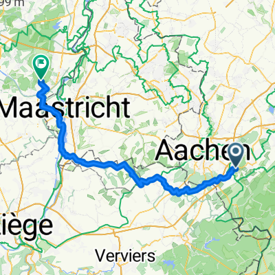
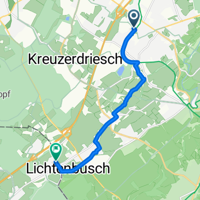
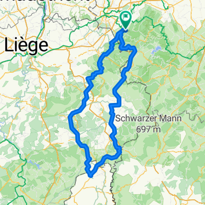
Stolberg Solchbachtal Breinigerberg Stolberg
A cycling route starting in Stolberg, North Rhine-Westphalia, Germany.
Overview
About this route
- -:--
- Duration
- 24.8 km
- Distance
- 233 m
- Ascent
- 228 m
- Descent
- ---
- Avg. speed
- ---
- Avg. speed
Route quality
Waytypes & surfaces along the route
Waytypes
Track
8.3 km
(34 %)
Busy road
7.2 km
(29 %)
Surfaces
Paved
13.3 km
(54 %)
Unpaved
8.9 km
(36 %)
Asphalt
12.5 km
(50 %)
Gravel
5 km
(20 %)
Continue with Bikemap
Use, edit, or download this cycling route
You would like to ride Stolberg Solchbachtal Breinigerberg Stolberg or customize it for your own trip? Here is what you can do with this Bikemap route:
Free features
- Save this route as favorite or in collections
- Copy & plan your own version of this route
- Sync your route with Garmin or Wahoo
Premium features
Free trial for 3 days, or one-time payment. More about Bikemap Premium.
- Navigate this route on iOS & Android
- Export a GPX / KML file of this route
- Create your custom printout (try it for free)
- Download this route for offline navigation
Discover more Premium features.
Get Bikemap PremiumFrom our community
Other popular routes starting in Stolberg
- Eifelsteig all stages
- Distance
- 313 km
- Ascent
- 1,671 m
- Descent
- 1,753 m
- Location
- Stolberg, North Rhine-Westphalia, Germany
- RTF Eilendorf "Schwalbe - Tour Nordeifel"
- Distance
- 110.6 km
- Ascent
- 1,288 m
- Descent
- 1,193 m
- Location
- Stolberg, North Rhine-Westphalia, Germany
- Donnerberg- Diepenlinchen- Stolberger Burg
- Distance
- 8.4 km
- Ascent
- 185 m
- Descent
- 188 m
- Location
- Stolberg, North Rhine-Westphalia, Germany
- Aachen-Venn-Eifel 85km-1080Hm
- Distance
- 83 km
- Ascent
- 809 m
- Descent
- 812 m
- Location
- Stolberg, North Rhine-Westphalia, Germany
- Route in Stolberg (Rheinland)
- Distance
- 158.3 km
- Ascent
- 3,196 m
- Descent
- 3,190 m
- Location
- Stolberg, North Rhine-Westphalia, Germany
- Vlissingen
- Distance
- 250.6 km
- Ascent
- 111 m
- Descent
- 283 m
- Location
- Stolberg, North Rhine-Westphalia, Germany
- AC-Jülich-EIfel-AC
- Distance
- 68.2 km
- Ascent
- 398 m
- Descent
- 398 m
- Location
- Stolberg, North Rhine-Westphalia, Germany
- Indetal und Altstadt von Stolberg
- Distance
- 27.4 km
- Ascent
- 249 m
- Descent
- 248 m
- Location
- Stolberg, North Rhine-Westphalia, Germany
Open it in the app