

I BTT CONCELLO DE O PINO
A cycling route starting in Touro, Galicia, Spain.
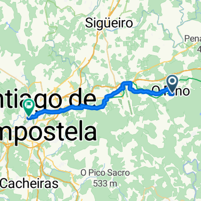
Overview
About this route
Distance: 42.66 km Time: 2h 58min 27sec Average Speed: 14.38 km Ascent / Descent: +854.5 / -857.4 Max Speed: 61.7 km
Between km 32.05 - 36.45, I missed a route sign so I had to go back to find the route further ahead and ride that same section again. In total, almost 4.5 km extra...
- -:--
- Duration
- 42.8 km
- Distance
- 624 m
- Ascent
- 627 m
- Descent
- ---
- Avg. speed
- ---
- Max. altitude

Continue with Bikemap
Use, edit, or download this cycling route
You would like to ride I BTT CONCELLO DE O PINO or customize it for your own trip? Here is what you can do with this Bikemap route:
Free features
- Save this route as favorite or in collections
- Copy & plan your own version of this route
- Sync your route with Garmin or Wahoo
Premium features
Free trial for 3 days, or one-time payment. More about Bikemap Premium.
- Navigate this route on iOS & Android
- Export a GPX / KML file of this route
- Create your custom printout (try it for free)
- Download this route for offline navigation
Discover more Premium features.
Get Bikemap PremiumFrom our community
Other popular routes starting in Touro
 A Rúa - Santiago de Compostela
- Distance
- 23 km
- Ascent
- 334 m
- Descent
- 353 m
- Location
- Touro, Galicia, Spain
 Compostelle - Faro
- Distance
- 1,099.4 km
- Ascent
- 1,406 m
- Descent
- 1,774 m
- Location
- Touro, Galicia, Spain
 De Aeropuerto de Santiago de Compostela a Praza do Obradoiro 3, Santiago de Compostela
- Distance
- 460.5 km
- Ascent
- 14,154 m
- Descent
- 14,259 m
- Location
- Touro, Galicia, Spain
 ride from July 5, 07:13
- Distance
- 26.4 km
- Ascent
- 356 m
- Descent
- 371 m
- Location
- Touro, Galicia, Spain
 I BTT CONCELLO DE O PINO
- Distance
- 42.8 km
- Ascent
- 624 m
- Descent
- 627 m
- Location
- Touro, Galicia, Spain
 Camino day 5
- Distance
- 19.7 km
- Ascent
- 365 m
- Descent
- 370 m
- Location
- Touro, Galicia, Spain
 Etapa 14 Pedrouso-Santiago de Compostela 20 km
- Distance
- 19.2 km
- Ascent
- 288 m
- Descent
- 304 m
- Location
- Touro, Galicia, Spain
 34 O Pedrouzo - Muros
- Distance
- 84.6 km
- Ascent
- 722 m
- Descent
- 990 m
- Location
- Touro, Galicia, Spain
Open it in the app